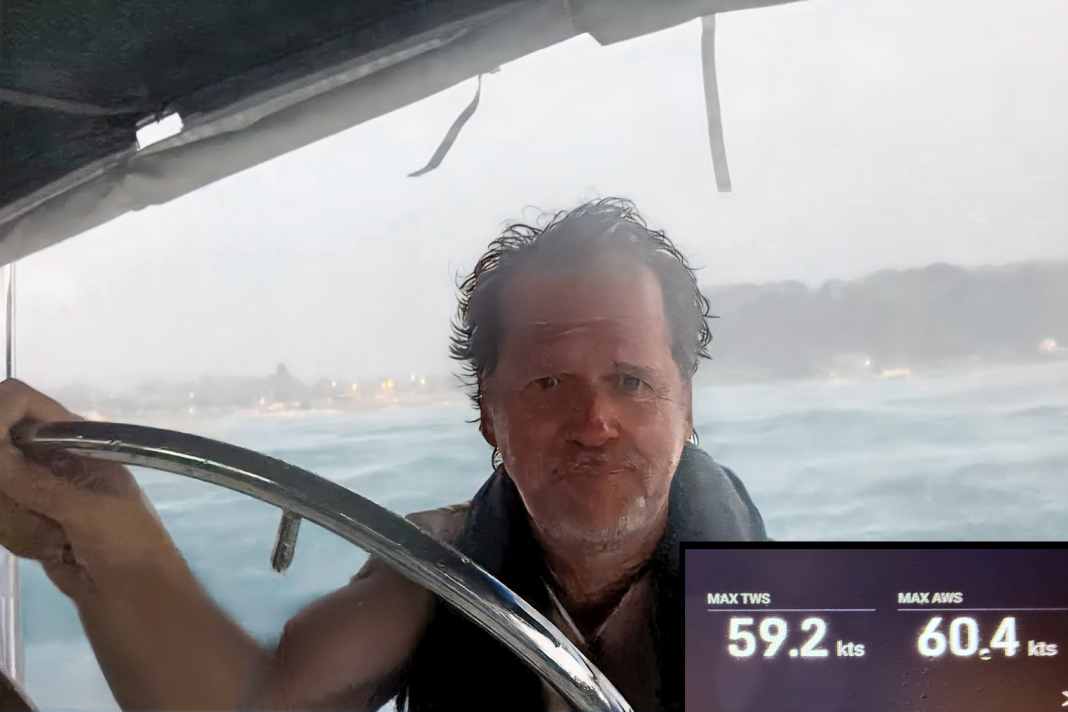


In the late afternoon of 16 June, the Croatian Adriatic coast was hit by severe storms (we reported). The west coast of the Istrian peninsula was particularly badly affected, with the popular holiday town of Rovinj at the centre of the storm. Measurements showed wind speeds of up to 110 kilometres per hour. The effects of the storm were devastating: trees were uprooted, houses and cars were damaged and around 30 boats were stranded. The Schmidbauer couple were anchored off Rovinj during the storm and experienced its full force. Peter Schmidbauer describes how they prepared for the storm, the anxious minutes while the gusting winds battered their boat and draws lessons from the storm that should be of interest to every sailor.
From Peter Schmidbauer
The weather situation
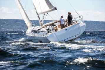
My wife Ernestine and I took our Jeanneau SunOdyssey 36.2 "Namaste", built in '98 with various refits over the past four years, on a short one-week trip from Umag along the coast of Istria with a short detour across the Bay of Kvarner to the island of Unije. We had two guests on board who had to be back in Rovinj on 16 June, and we wanted to sail back to our marina in Umag for another two days. (Here you can find Cruise suggestions for Croatia.)
The weather models (ECMWF, ICON) have already indicated a high CAPE value for several days and thus a high probability of thunderstorms for the whole of Istria on Monday.
Background knowledge: CAPE value
According to the German Weather Service, the CAPE value (CAPE = Convective Available Potential Energy) and the "Lifted Index" are used to assess the strength/intensity of Thunderstormn. CAPE (the maximum available potential energy for Convection) is a measure of how strongly an air parcel can be lifted. High CAPE values (>2000 J/kg) in combination with a clearly negative Lifted Index are an indication of the occurrence of very high reaching and therefore usually severe thunderstorms.
CAPE is therefore greater the warmer the rising air parcel is compared to the ambient air. CAPE is also greater if, in addition to the previous condition, the near-ground Water vapourcontent is all the higher. These conditions lead to a positive uplift - CAPE.
| CAPE [J/kg] | Lability / thunderstorm |
| 0 to 500 | Weak |
| 500 to 1000 | moderate |
| 1000 to 2000 | strong |
| 2000 to 3000 | very strong |
| 3000 + | extreme |
Further in the report
A moderate bora was generally announced. The Croatian weather service issued a yellow warning (1st of 3 levels) for the Istrian coast. Our original plan was to moor safely at a buoy in Rovinj on Monday for the thunderstorms. On Monday, we checked our Windy app (premium version) several times to compare the models. Of all the models, ICON-D2 was the only one that predicted the possibility of extreme winds, but with different strength, direction and spread over almost the entire coast of Istria to the Kvarner Bay with each update. (To the overview of the best weather apps.)
We briefly considered whether we could still manage to dodge to the north or south. However, the announcement was too large-scale and we quickly realised that this would be too risky if the ICON-D2 forecast was correct.
So our focus was on preparation. We put our guests ashore safely with the dinghy (Tips for dinghy handling), and the two of us then played through the various strategies. It was deceptive that it was still a beautiful afternoon at the beach at the time - apart from the ICON-D2 model, there was no sign of the chaos that was to ensue later.
Of course, we hoped that the ECMWF model's forecast would be right and that the wind speed would be a maximum of 30 knots. Nevertheless, we assumed the worst-case scenario from around 4.00 pm.
The preparation
The question then was: ACI marina in Rovinj, buoy field in the bay south of the old town or anchoring in the bay north of the old town? Due to the westerly onshore winds, we didn't have a good feeling about the marina and buoy. We knew from previous stays that the northern bay generally offers good anchorage and that there probably won't be much going on there, so we'll have space. On normal days, the problem there tends to be the unpleasant swell, but the anchor has always held very well on the first attempt.
The decision was then made in favour of the anchor for the following reasons:
- More damping on the anchor chain compared to the short mooring line on the buoy.
- Compared to the onshore buoy field, there is more free space and fewer other yachts in case something goes wrong with us or others.
- Trust in your own setup instead of other people's buoys.
We used a 15-kilogram Rocna anchor and 55 metres of chain and anchored at a water depth of around nine metres; the full 55 metres were set. According to the calculation with the Anchor Chain Calculator app, the system should be able to hold around 60 knots in our case. At that moment, I didn't dare to imagine that we would later be testing these 60 knots in real life. Click here for the large, three-part Anchor special.)
We anchored with the engine running at maximum power in a westerly direction, almost 180 degrees (and in the wrong direction, so to speak) to the northerly wind that was still prevailing at the time. We set our Grippy anchor buoy as a marker. In addition to the anchor alarm on the iPhone, we also marked the anchor position on the plotter.
The whole thing was secured with an anchor claw, with a Dyneema soft shackle as a second backup behind it, through the chain with a tap spot from a mooring line to both cleats. (Instructions to Dyneema soft shackle produce it yourself).
A cruise ship was anchored next to us, behind us a charter crew came into the bay about 30 minutes before the storm, but with the wind still blowing from the north-east they anchored relatively far into the eastern part of the bay near the campsite.
As hoped, we had room to swing and a little buffer for possible drift.
We made everything on the boat storm-proof, everything was lashed down, double-checked, unnecessary items stowed below deck - so we waited for what was to come, the live weather radar and the forecast in the iPhone constantly in view.
The storm
The wind changed to westerly just before the front and a dark roller appeared in the sky behind the small headland where we were lying. Shortly afterwards, flying water could be seen in the distance. The next time we looked, the nearby cruise ship was covered in spray. Then the old town centre of Rovinj disappeared, only the church tower at the top of the hill was still visible, everything else was just a wall of white spray.
For us, this meant starting the engine, as we always do in thunderstorms, and putting on life jackets. With the first gust roller, it pushed us from 0 to 100 with extreme heeling on the side, so to speak. Our gauge ended at 35 degrees, so there's no exact figure here, but the foot rail was definitely in the water and we were just trying to keep ourselves on board.
With motor support
In a very short time, high waves built up which, in combination with the strong gusts of wind, tossed us wildly from one side to the other. Ernestine wedged herself into the alcove of the companionway, I was at the wheel at the back and tried to hold against it with engine assistance to take the strain off the anchor gear.
This counter-attack with the engine sounds much easier in theory than it was in practice: if you overrun the chain, the wind immediately pushes the boat sideways with the bow and you lie crosswise to the wind, the next gust then has the full length of the boat as an attack surface. In addition, you can no longer judge how the old Yanmar engine, which in our case only had 27 hp, is doing in the roar, because you can't even hear whether it is still running at all due to the howling wind and the torrential rain that is pelting down on you.
After a bit of a roughening up and less hectic engine thrusts, which you automatically tend to do at the beginning, I was able to stabilise the boat to some extent and keep it in the wind, alternating between hard to port and hard to starboard rudder with every wave - sport at the helm, which, in combination with the wet and sudden cold, took a lot of energy.
Protection from rain
We have a rain cover that we can zip between the sprayhood and bimini in bad weather. Although this creates a little more wind resistance, it definitely provided protection from the massive rain that was hurled at us in 110 km/h winds. As the water was coming from all sides, everything still got wet quickly, but it wasn't quite as painful on the face. Without protection, you would at least have to wear goggles, otherwise you wouldn't be able to stand it for long, especially in your eyes.
It was very helpful that our anchor position was marked on the plotter and the ship's position was shown as a track. This gave me a good idea of where the anchor was in relation to us and whether we were drifting, which fortunately wasn't the case. We had absolutely no visual orientation to the land in the first few minutes due to the massive spray - the plotter display was the only reference.
Speaking of drifting - the cruise ship had drifted several hundred metres towards the city pier when we could see it again, now suddenly diagonally behind us, as the situation calmed down slightly.
The situation calms down
The phase with the 60 knots of wind that our wind sensor at the top of the mast indicated lasted about 15 minutes. Unfortunately, we didn't have a GoPro mounted and we really didn't have our hands free for the iPhone at that moment. After 15 minutes, the worst was over. Overall, the situation calmed down after three hours at around 22:00, the wave stayed a little longer and the wind shifted back to the north-east.
The wind against the waves was a brief challenge at the helm to control the cross-lying to the waves and the resulting heavy rolling.
We were able to go below deck at around 23:00 and even slept relatively well. The anchor alarm remained silent all night. At around 5:00 a.m., a moderate bora came up with around 25 knots, which felt like a wellness holiday in comparison.
We were later able to read up on exactly what a classic Nevera looks like.
Background: The Nevera
A nevera is a sudden onset thermal thunderstorm cyclone with gusts of wind up to hurricane force. It always comes from the direction of the open sea (west) and, unlike a bora, is unpredictable locally. The Nevera only lasts around 15 to 45 minutes, but has an unusually high destructive force on its localised path of a few kilometres. Heavy rain usually sets in at the end of the storm. Nevera storms occur almost exclusively in summer, with a clear concentration in the months of August and September.
The damage
The colleagues on the charter yacht behind us managed not to run aground - all respect to them for anchoring as onshore as they did. However, their mainsail looked as if it had been torn out in the wind and damaged. Their genoa had also unwound a bit.
In the nearby shipyard on land, an upright sailing yacht was overturned, including a broken mast. Several yachts were stranded in the buoy field. We don't know whether there was also yacht damage in the marina.
Trees were uprooted at the campsite directly in our bay, and unfortunately there was a life-threatening injury to a person who was trapped under a tree.
Rovinj was in a state of emergency all night, with flashing blue lights everywhere. Ambulances were travelling in all directions. During the night, chainsaws could be heard everywhere, sawing up fallen trees and branches and clearing them away.
We survived this storm completely unscathed and are very proud of our 27-year-old "Namaste", which protected us safely from the forces of nature. We only had to sacrifice the anchor claw to Neptune, as the line broke. The back-up with the soft shackle and the mooring line was our saviour here, as the winch would probably not have held the forces, nor would the safety line that we have at the end of our anchor chain. Then it would have been a completely different scenario.
The review
Preparing for the worst-case scenario has paid off. Everything you've done beforehand is worth its weight in gold, because the situation can get so wild so quickly that there's not much you can do. The forces involved are massive and difficult to describe.
During the 60 knots of wind and the wave, in which the boat was being tossed around like a plaything, you're already busy in the cockpit trying not to fall overboard. I think it's very dangerous and almost unrealistic to have to go to the foredeck and then try to do anything useful. Even as a sporty person who is well-pitched, we have appropriate stretch ropes on board, I would only want to consider this as a last resort.
In the storm itself, we were both very clear and never had the feeling that we couldn't make it. We trusted the ship and each other and were a very good team with clear communication and task allocation. It was only when the storm was over that we realised how exhilarated we were by the adrenaline.
It was a situation at the limit, where small things could have triggered a disaster.
At the same time, it was an incredible experience that boosted our confidence in our boat enormously but also reaffirmed our respect for nature.
The manoeuvre critique
What we would do differently next time:
- Don't blindly trust older lines, in our case the anchor claw, and replace them early. Without the backup with the Dyneema shackle, things could have turned out very differently for us.
- Even if it's still a humid 28 degrees just before the thunderstorm and you're already sweating in your T-shirt and swimming trunks, it's best to put on your oilskins beforehand. Everything then happens incredibly quickly and at the height of the storm there was no longer any thought of putting on a jacket, let alone oilskin trousers - with the result that you quickly cool down due to the wetness, wind and drop in temperature and use up energy unnecessarily.
- In future, we will have clear-view goggles within reach in the cockpit during thunderstorms. The rain lashing into your face should not be underestimated.
- Attach the GoPro with a sturdy mount and start filming. As a small crew, it was not possible for us to deal with it at that moment. Afterwards, however, it is difficult to describe or convey the experience in an authentic way - moving images would be very helpful. It would also be interesting to have some kind of continuous documentation in the form of a video for the debriefing.
Basically, we were well prepared and are grateful that we and our "Namaste" came through it so well. We would like to take this opportunity to wish all those who were injured the very best, and above all a speedy and full recovery to the injured.

Lars Bolle
Chief Editor Digital

