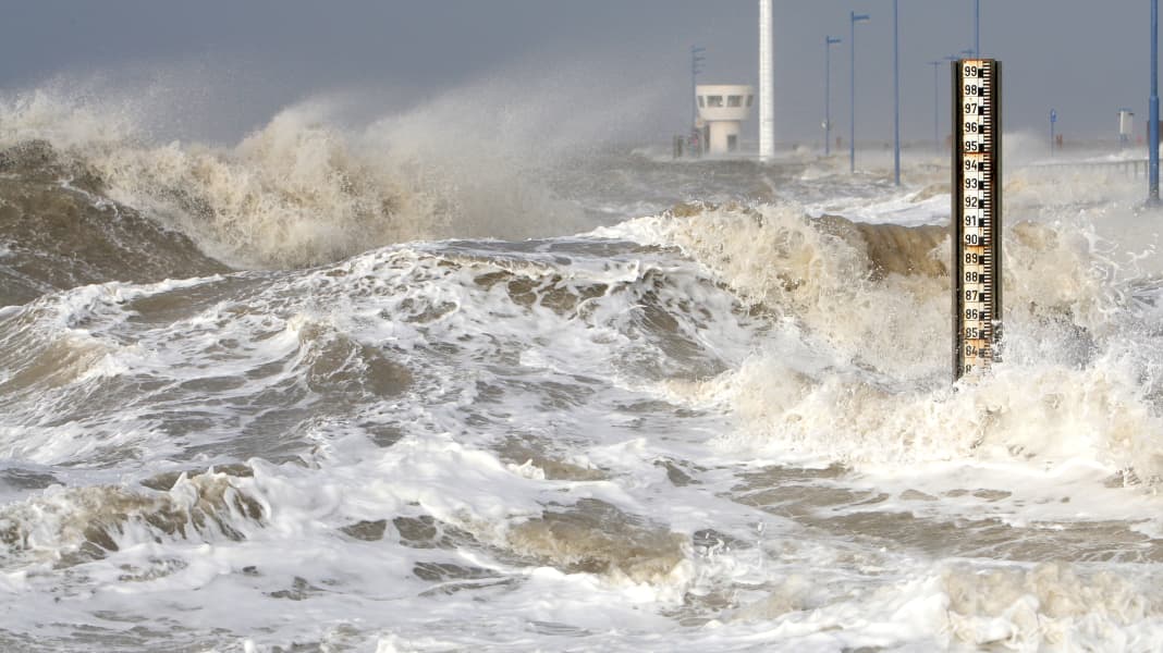
The authority warns that the risk of storm surges on the German North Sea coast increases significantly from October to April. It writes: "In the winter half-year 2021/22, there were 16 storm surges on the German North Sea coast, three times as many as the long-term average. The storm surges occurred more frequently in chains, with one storm surge followed by the next within 48 hours."
Longest storm surge chain since records began
For example, six storm surges occurred between 30 January and 7 February, two of which were severe. Shortly afterwards, from 17 to 22 February, the longest chain of storm surges since 1990 was recorded with seven storm surges. They were caused by several consecutive strong storm lows with gale-force winds from a north-westerly direction.

Such storm surges affect the large estuaries far inland. On the night of 19 February, strong gusts of wind led to a storm surge in Hamburg that was as severe as the long-term average of only once every five years. "At the St. Pauli gauge, the water level reached 3.75 metres above mean sea level (5.88 metres above sea level). The highest water level to date was measured in Hamburg in 1976 at 4.65 metres above mean sea level (6.45 metres above sea level)," the BSH said.
On the same night of 19 February, there were also severe storm surges in the wider Elbe region and in North Frisia, as well as storm surges in East Frisia and the Weser region.
What can we expect this winter?
The BSH cannot look into the future either, so it does not know whether such severe weather events can be expected in the coming weeks and months. However, measurement data from the summer could provide an indication of this. The months of June, July and August were among the warmest not only in Germany, but in the whole of Europe since records began. According to the BSH, this is also reflected in large areas of the North Sea and Baltic Sea.
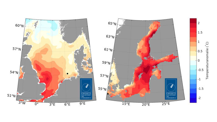
Compared to the long-term average from 1997 to 2021, the surface temperatures of the North Sea were warmer in the summer of 2022. This is particularly true for the south-western part, near the east coast of England and the English Channel. This year's water temperatures there exceeded the long-term average by one degree Celsius. Towards the north and east, the deviations from the long-term average decreased somewhat, and in the northernmost area it was even slightly cooler.
The analysis of the measurement data also showed that a marine heatwave occurred in the German Bight during the summer. "It lasted a total of eight days, and the temperatures at a depth of three metres were a maximum of two degrees above the long-term average," reports the BSH. This makes the heatwave an extreme event, albeit not an exceptional one. Since 1989, a total of 42 marine heatwaves have been recorded at the station, according to the report.
Baltic Sea over 1.5 degrees warmer
A more extreme picture emerged for the Baltic Sea. According to the BSH, surface temperatures here in the summer of 2022 were 1.5 degrees and more above the long-term average over large areas. This particularly affected large areas between southern Sweden and the Baltic States as well as the areas to the north. "Off the German coast, the deviation from the long-term average was around one degree. This also applies to the Mecklenburg Bight and the Pomeranian Bight," the report states. For large areas of the Baltic Sea, this was the fourth warmest summer since 1997.

And: two heatwaves were recorded at the BSH measuring station "Kiel Lighthouse" in June/July and August/September. The first lasted ten days and the temperatures in 0.5 metres of water were a maximum of three degrees above the long-term average. "The second heatwave even lasted 19 days and temperatures were a maximum of 2.5 degrees above the long-term average," said the BSH.
Climate change leads to an energy surplus in the oceans
Nevertheless, the following also applies to the Baltic Sea: "A total of 65 marine heatwaves have been observed there since 1987. The two heatwaves in summer 2022 are therefore not exceptional." Nevertheless, the authority emphasises the connection between the rise in water temperatures and the corresponding effects on the climate and weather patterns.
The report concludes: "Climate change is leading to an energy surplus, over 90 per cent of which is stored as heat in the sea. Warmer seas have far-reaching consequences for the marine environment. In addition, the oceans in turn have a major influence on weather and climate events. For example, the temperatures of the North Atlantic influence the course of winter in Central Europe."
The Federal Maritime and Hydrographic Agency
The BSH is Germany's central maritime authority. Around 1,000 employees from over 100 professions work at the offices in Hamburg and Rostock and on five ships. Its tasks centre on the promotion, safety and monitoring of maritime shipping, research and collection of long data series in the field of oceanography and marine chemistry, the water level forecasting service and nautical hydrography, which involves the production of official nautical charts.
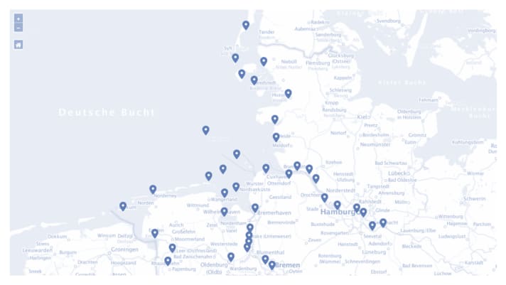
In the event of extreme flooding, the BSH issues early warnings to shipping, companies and people in areas at risk of storm surges via telephone, radio and the internet. The BSH has also recently started issuing warnings via the NINA and KATWAR warning apps and a new website.All Water level forecasts can also be found on the Internet. There you will also find all Storm surge warnings retrievable.
On the German North Sea coast and in Emden, Bremen and Hamburg, a storm surge warning is issued from a water level of 1.5 metres above mean high water (MHW). From a water level of 2.5 metres above mean high tide, it is a severe storm surge and from a water level of 3.5 metres above mean high tide, it is a very severe storm surge. The number and severity of storm surges varies greatly from year to year and from place to place along the coast. In addition to the course of the tide, wind direction and speed, the shape of the coast also influences the water level.
This might also interest you:

Pascal Schürmann
Editor YACHT

