Baltic Sea round trip: To Haparanda and back along the Swedish and Finnish coasts
Kristina Müller
· 03.02.2024


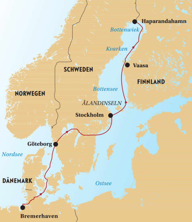
Dark clouds chase across the sky. Thunder rumbles over the Bothnian Bay - not particularly inviting weather for the next beat, but we are no longer wanted at our mooring on a tiny, privately owned Finnish island. What's more, only 60 nautical miles separate us from the destination we're longing for and the turning point of this trip: Haparandahamn, the northernmost Swedish harbour on our journey.
A few weeks earlier. In the home harbour on the North Sea coast, the departure chaos on board gradually dissipates. Equipment and provisions for the journey disappear into the lockers. We're ready to go: we're heading for the Baltic Sea, which everyone is raving about. We, a crew of two, are dreaming of the eastern Swedish archipelago - and perhaps also of the area further up north.

Kiel Canal and Göta Canal as a back door
The original idea of sailing from the North Sea via the Limfjord to the Baltic Sea falls victim to the weather. The Kiel Canal is a welcome shortcut.
"We've got six months!" says the skipper of a French steel yacht as it moors in front of us in the Brunsbüttel lock. His family with three children want to take a break from sailing and sail via Skagen to Iceland and from there back to Brittany. That would be something too!
In fact, we unconsciously follow the French at first. The wind is to blame. It's blowing from the east - the direction we want to go. Even in the long-term forecast: an endless easterly wind. When the days-long storm subsides a little, we speed out of the Kiel Fjord towards Denmark. The decision is made there: We don't wait for better conditions, but sneak into eastern Sweden through the back door, the Göta Canal.
Actually, the inland route from the west to the east Swedish coast was at best an option for the return journey. Now it is a tempting alternative and the prospect of 58 locks - and therefore 116 lock manoeuvres - only seems half as challenging. Especially as everyone who has been there raves about the canal trip.
The archipelago awaits off Gothenburg
Euphoric at the new prospect, we follow the French into the Kattegat. With a strong easterly wind, the fully loaded boat shoots across the Great Belt. Sejerø is still in hibernation, and even on Anholt there is hardly anything going on. Although the island is enchanting, the water on the sandy beach shimmers turquoise and live music is played in the harbour in the evenings, we resist the urge to stay and sail towards Gothenburg, the gateway to the hinterland.
As we approach the Gothenburg archipelago, we are immersed in a different world. As North Sea sailors, we are used to sandbanks and tides, but not this teeming mass of thousands and thousands of islets. Our eyes and minds first have to get used to the new picture on the chart and in front of the bow. So many rocks that need to be navigated around. So many hiding places where the anchor could drop!
Shortly before Gothenburg, the impressions continue to pelt us: the huge Älvsborgsbron bridge ahead, the Maersk tankers on the port side, ferries without end - and our little steamer in the middle of it all. Even if the comparison is a bit of a stretch: Sailors who have crossed the Atlantic and passed the Statue of Liberty must feel something like this.
"Come to the bridge, it will open for you!" The information on VHF channel 9 comes quickly and is clear: just drive in front of the lift bridge and it will be lifted for us. Hisingsbron is Gothenburg's main traffic artery. Cars, buses and trams move across it from one bank to the other. The only reason everyone is stopping now is because we are the only boat that wants to go through. Unbelievable.
From Gothenburg, we spend two days chugging 82 kilometres along the Göta älv river and the Trollhätte Canal towards the Göta Canal. Despite the counter-current, the journey is relaxed - up to kilometre 65, where the imposing Trollhättan lock staircase begins. In four chambers, yachts, excursion boats and freighters are each transported a good eight metres up or down. Material for lock cinema!
Four days of anchoring adventure on Lake Vänern
This is followed by a bridge, a lock, a stop for provisions in Vänersborg, then suddenly we are sailing on one of the largest lakes in Europe, Lake Vänern. We take four days for the crossing, discover great anchorages and don't call at a single harbour. The alarm clock rings early to take advantage of the morning breeze. Instead of a shower, we take a dip in the lake, which is still far too cold for that. We also register with the Göta Canal administration. In the low season, boats can only pass through in convoy and according to a timetable. Let's go!
We experience five sporty days: In 21 locks we work our way up 91 metres in altitude, then back down again in 37 more chambers. We cross five lakes, on which we sail 36 miles, and pass 48 bridges. Together with the other crews, we grow into a small community of fate and are happy at the end when it's all done.
The canal trip catapults us to our dream destination: we have reached eastern Sweden! Up to this point, everything has felt like an overpass. Now the narrowness of the canals is behind us, something new is beginning. A southerly wind quickly drives us towards Stockholm. There we moor in the harbour of a sleepy suburb and take the bus and train into the city for the day. This is how you buy a ticket: hold your credit card in front of the scanner on the bus, something is debited, then you can travel for 75 minutes. A little opaque for strangers, but simple and cheap.
Dreamlike archipelago off Stockholm
After a day in the hustle and bustle of the city, we stock up on provisions and immerse ourselves in the fascinating archipelago that stretches out in front of the city. One bay is more beautiful than the next. Many end up at the top of our list of favourites in no time at all.
As we sail out to the outer archipelago, it becomes clear that things can be different here. The swell rocks us, the wind makes the boat shoot through the islands. Ballerbü instead of Bullerbü! We were already a little lulled by gliding through the inner archipelago.
In the meantime, we are asking ourselves how we should continue. Once we had the first 400 nautical miles in our wake, slowly got used to the journey, had already coped with some waves and wind and realised that we and the boat were working as a unit, we dared to think about a whole round trip around the Gulf of Bothnia for the first time while chugging along Sweden's canals. In other words, not only sailing along the Swedish coast, but also the Finnish coast. But in which direction - clockwise or anti-clockwise? There are arguments in favour of both.
We postpone the decision and sail to the Åland Islands. For shopping. We've been trying to buy Finnish nautical charts since the Göta Canal. But even the boat chandlery in Stockholm didn't have them. "Our archipelago is beautiful enough!" the salesman explained with a grin. But after a call to the bookseller in Mariehamn on Åland, it is clear that they have the maps we need. A local bike dealer should also have suitable 14-inch tyres for our flat bike. We also searched in vain for these in Sweden; the shops only had 12 or 16-inch tyres.

A light northerly wind, hardly any waves, plenty of sunshine - the 42 nautical miles to Mariehamn are some of the most beautiful of the journey so far. The capital of the Ålands, like the whole archipelago, feels special: far away from everything and beautiful. The archipelago is an autonomous region of Finland, but the people speak Swedish and feel more like it. We get hold of nautical charts and bicycle tyres, stroll through the cosy town to the four-masted barque "Pommern", then continue on our way.
Unfortunately, the information in our cruising guide is out of date. Some of the jetties in the archipelago are no longer in use. So we practise creative mooring manoeuvres on abandoned or half-demolished jetties - a foretaste of Finnish solitude. On the last of five days in the Ålands, we sail 40 miles through the archipelago in one go from south to north, heading for Finland. The navigation requires a lot of concentration, but the ingenious guidance system leads us safely through the island labyrinth.
Night cruise around midsummer
The midnight sun and the bright summer nights were part of the idea behind choosing Scandinavia as the destination for this trip. From here, at the southern end of the Gulf of Bothnia, it doesn't get really dark around midsummer. It is the perfect area for long days on the water and night sailing without darkness.
When a good wind is forecast - 5 Beaufort from the south-west - we use the lift to the north. We sail 150 nautical miles non-stop towards Vaasa. The boat shoots through the night, the waves get higher. This Bothnian Sea is no playground.
Shortly before midnight, the sun sets on the port side ahead, and three and a half hours later it rises again on the starboard side in front of the bow. In the meantime, we head towards the orange-pink glow on the horizon, always at longitude 21. There is hardly any ship traffic up here - unusual, but perfect for this exhilarating journey. After 32 hours, we moor in a small harbour.
Finland's coast is terra incognita for sailors
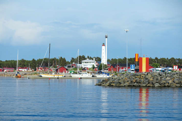
Welcome to the Finnish outback! We have landed in one of the small, shallow fishing harbours, of which there are dozens along the coast here. Without infrastructure such as showers or shops, but also without mooring fees. They divide the often long distances between the few marinas into small bites. In the days that followed, we landed with the friendly fishermen again and again.
The Finnish coast in the Kvarken and Bottenwiek areas seems more isolated than the Swedish coast. A bit like terra incognita for sailors. Few other crews are out and about here - especially not in the fishing harbours. So we enthusiastically radio a German yacht that we meet on the opposite course. Finally a little exchange!
"July is the season in Finland," I read, and: "It starts here from midsummer!" We wait eagerly for the boats and people who should finally be arriving - but it remains empty. A beautiful spot without the hustle and bustle. But you have to like that. Maybe we're just too early after all?
Fog and rain plunge the longest day of the year into dense grey. Fog the next day at sea too, with an old wave and little wind.
Separation from Finland is difficult
The holiday island of Hailuoto could have been the perfect end to this trip along the Finnish coast. From here, it's only a good 60 nautical miles - a day at sea - across the Bothnian Bay to Haparandahamn, our northernmost destination. But somehow we can't part with Finland just yet.
We manoeuvre the boat to the jetty in a tiny island harbour, where only one fishing boat is moored. A yellow sign with red lettering and an exclamation mark reads in Finnish: "Mooring only with the owner's permission!" He soon comes out of the only cottage on the island and authorises us to stay the night. The next morning: thunderstorms all around us.
The worst is over by midday. The sky clears and the wind shifts in the right direction. We head out to sea and cross before the wind, which unfortunately dies far too quickly. At only three to four knots, we head for Sandskär, an island in the archipelago off Haparandahamn.

The gusts come suddenly. "Genoa in!", I shout, and less than a minute later we're still under main and reefed jib, but now heading north again at seven knots. The cloud that had crept in from astern is obviously another thunderstorm. We switch on the radar and watch the front passing on our port side.
The calculated arrival time has jumped forward. Not far to our destination, we can already see Sandskär on the horizon. But the shifting wind brings onshore seas that continue to build. In these conditions, heading for the exposed little harbour seems irresponsible. So we hunker down in the shelter of the archipelago and sail straight through to Haparandahamn. Even if that means a cross through the tangle of rocks in the middle of the night. It doesn't get really dark.
One front now runs in front of us, one next to us. But apart from a little rain and a waterspout far ahead, it remains peaceful. We sit dry under the bimini, the wind steering system keeps us on course. Two Q-tacks bring us into the shelter of the archipelago - done, back in Sweden!
Zigzag course through the islands off Haparandahamn
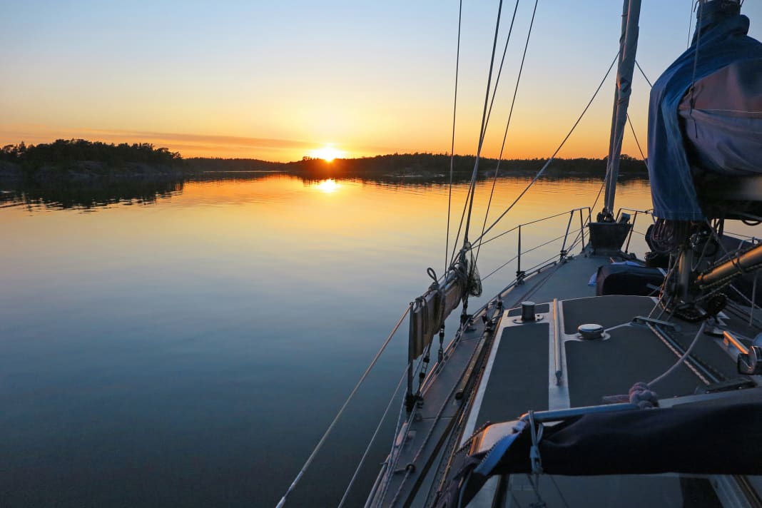
It's just before midnight. The sun sets and rises again less than an hour and a half later. The skerries surround us as dark shadows. We have to get higher and higher into the wind and reef the main. I steer towards the buoys that lead through the rocks. It's a tingling feeling, heading towards the destination of this journey in the middle of the night - zigzagging through a world of islands that we would never sail through in real darkness.
We arrive shortly before three in the morning. Completely groggy, completely happy.
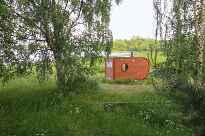
Haparandahamn is a beautiful spot on earth. Guests are warmly welcomed in the yellow wooden house of the local boat club. There's not much else here: a wood-fired sauna, a toilet block and lots of woodland. There is also a small club harbour with lots of motorboats and a guest jetty that doesn't fit many yachts, but that never seems to be a problem.
In the evening, we sweat in the sauna with a view of the harbour and make plans for the return journey. As nice as it is to have reached the northernmost point of our journey on the Baltic Sea, it was a long 1,400 nautical miles to get here. And that's exactly what lies ahead of us now.
To be continued.

