Weather: Waterspouts on Lake Constance - meteorologist Sebastian Wache explains the phenomenon
Sebastian Wache
· 31.07.2025


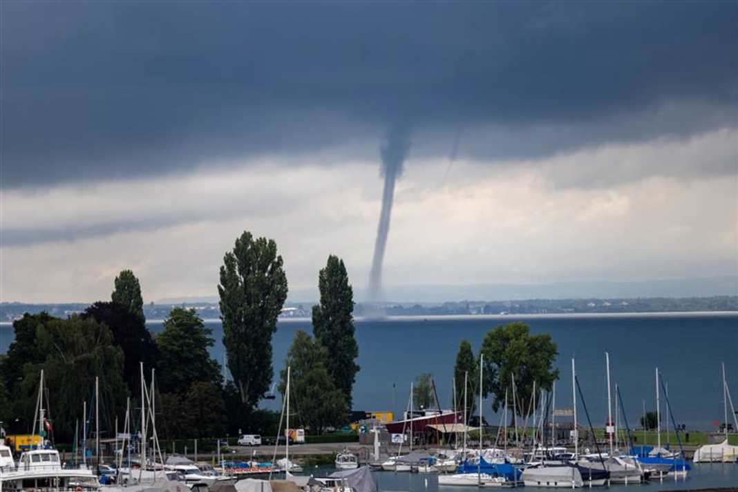
A waterspout about 800 metres high rose into the sky over Lake Constance on Tuesday morning (29.07.). The vortex above the water had a diameter of 50 metres. Although such a phenomenon may seem unusual, they are not uncommon over Lake Constance. According to Jens Winninghoff, a tornado expert from the German Weather Service, two to three waterspouts are registered on Lake Constance every year. As a large body of water, Lake Constance is virtually predestined for the development of such weather phenomena. According to the catamaran shipping company, only experienced skippers should be travelling on Lake Constance.
At what time of year do tornadoes form?
Summertime is also the time for waterspouts. At least the start of the season, which continues into the autumn. This is because the water masses in the North Sea, Baltic Sea and Mediterranean are very warm. Warm air is lighter and rises. Warm water also evaporates more. As soon as we have weather conditions that favour the formation of cumulus clouds, the warm, humid air masses can be used as energy for this. This requires the lowest possible cloud base. The surrounding warm air masses are literally drawn upwards into the clouds like a hoover. An upward suction can already be seen. If the wind blows from a different direction at ground level than at altitude within the clouds, the rising air begins to rotate. Negative pressure in the cloud cools the air and the water vapour becomes visible. A funnel forms downwards from the cloud, this is called a "funnel". Only as soon as this funnel makes contact with the ground do we speak of a waterspout, tornado or tornado. These are three terms for one and the same phenomenon.
But it doesn't always have to be just one waterspout. Each source cloud has its own updraft channels, so that several funnels or even tornadoes can become visible at the same time. As the friction over water is lower than over land, waterspouts often last longer here and form more frequently even in summer and autumn. How a waterspout turns is a lottery of nature. The Coriolis force of the earth (deflecting force due to its rotation) has no effect on such small-scale formations. Rain showers or thunderstorms are not necessarily required for waterspouts. This is referred to as a type 2 tornado. In contrast, type 1 tornadoes are associated with strong vertical wind direction changes and rotating thunderstorm cells. These are known as mesocyclonic tornadoes and occur less frequently over water.
How do waterspouts form?
There are four different weather conditions in which waterspouts can form. In cold seasons, when cold mountain air meets quite warm water, but the overall wind is quite weak. In summer, there should also be less wind. If we then have so-called convergence zones (where air masses are brought together), the process begins where air masses can rise, cumulus clouds form and a waterspout may form at the end. These type 2 tornadoes, which are typical of waterspouts, are rarely seen on strong squall lines or in the vicinity of supercells (strong thunderstorm cells). It is usually the destructive type 1 tornadoes that are seen here. The frequency of tornadoes can hardly be precisely quantified. Although more are now reported than in the past, this is also due to more eyewitnesses and the possibility of recording sightings on mobile phones. Nevertheless, it is assumed that the number is unlikely to have increased, even in times of a changing climate.
The strength of a waterspout
The strength is determined using the Fujitas scale. However, it is difficult to measure due to the short-lived nature of the waterspouts. Most waterspouts in the North Sea and Baltic Sea are weaker and usually have a strength of F0 (90 km/h) to F1 (up to 150 km/h). In the Mediterranean, stronger waterspouts are also possible with F3 (up to 290 km/h) due to higher temperatures and humidity. The strengths of F4 (380 km/h) and F5 (470 km/h) are rare, at least on the water, and do not often occur on land either.
How often do they occur?
To date, "only" 11 force 4 tornadoes have been recorded in Germany since records began. Over the course of the year, we see around 45 tornadoes in Germany. Of these, 6 to 27 are waterspouts. That is the average per year in the North and Baltic Seas. Due to the size and different climatic conditions, there are probably significantly more in the Mediterranean, but I don't have any exact figures. The daily pattern is interesting. Most reports of waterspouts relate to the early morning and mid-morning. However, they are also possible in the afternoon and evening. At night too, of course, but the figures show that there are no reports for this. Simply because they are not visible due to the darkness.
Waterspouts when sailing
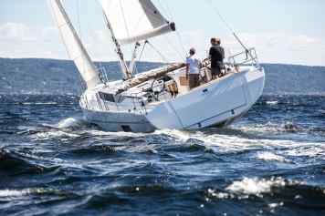
It turns out that it is precisely low-wind weather conditions that tend to cause waterspouts to form. So even during a summery high-pressure situation and champagne sailing, you shouldn't be surprised if a waterspout suddenly grows downwards from a cloud. But what is the best behaviour here? If we now know that wind speeds of more than 90 km/h can occur close to such a tornado, then there is already a lot of pressure involved. If you see a funnel or even a waterspout, it is important to start the engine and secure all loose items. This also includes the sails, which you should pack away as they offer a large area of attack.
And even without sails, supposedly weak waterspouts can tip boats completely on their side. In most cases, the mast alone is sufficient as a point of attack. There are plenty of videos on YouTube to illustrate this. Just type in "water spout mooring" or "anchorage".
What to do when waterspouts are ahead?
It is best to go below deck when a waterspout threatens without being hit by flying objects. If a helmsman remains on deck, it is important to pick up and hold on tight. Before you do this, however, keep an eye on the path of the waterspout, as they usually move with the clouds and are so small that you can avoid them and sail away even with the help of the engine.
If you would like to have an overview of all the reports or would like to report something yourself, you can find an overview on the Tornado list Germany all about it.

Sebastian Wache
Freier Mitarbeiter

