Hurricane: Storm depression brings first strong autumn storm
YACHT
· 23.10.2025

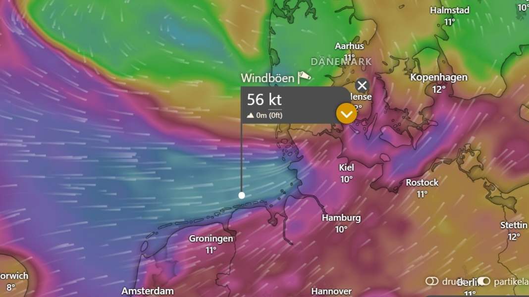
The low-pressure system "Joshua" reaches Germany on Friday night and develops into the first strong autumn storm of the year. Gale-force winds of up to 120 km/h are expected on the North Sea coast, and squalls are also expected on the Baltic Sea. The water level forecasts predict storm surges in the North Sea and low water in the Baltic Sea. If you can, you should secure your boat.
Storm for days
Storm "Joshua", also known internationally as "Benjamin", will initially hit the coasts of Belgium and the Netherlands today, Thursday. Gale-force winds are then possible, particularly in the province of Zeeland. The Netherlands has issued the second-highest warning level "orange" for the entire coastal region.
The depression will then reach the German North Sea coast on Friday night. The German Weather Service (DWD) warns of gale-force winds or gale-force gusts (11/12 Bft., 105 to 120 km/h). On Friday, the entire north will be under control and, according to the DWD, will bring "widespread stormy gusts, occasionally gale-force gusts (Bft 8/9). In the coastal area of the North Sea, heavy squalls (Bft 10). Directly on the North Sea hurricane-force gusts (Bft 11), especially onshore in the morning also isolated gale-force gusts (Bft 12). Wind from west-southwest." The depression will also bring heavy showers and even brief thunderstorms.
The North Sea coast is particularly affected, especially the area from East Frisia via the Elbe estuary, Dithmarschen to Sankt Peter-Ording, as DWD meteorologist Karsten Kürbis told NDR. Kiel meteorologist Sebastian Wache is forecasting gale-force winds for the west coast of Schleswig-Holstein and up to 110 kilometres per hour on the east coast.
"The problem with this low pressure system is that it will not have passed through on Friday, as it will continue to be blocked in the east by an area of high pressure," explains Sebastian Wache, "so we will also experience very stormy days on Saturday and Sunday." The changeable and windy weather, especially in the north, will therefore remain.
Storm surge on the North Sea, low tide on the Baltic Sea
The current curve forecast sees the evening high tide on Friday, particularly in the Elbe and on the west coast up to Büsum, at storm surge level with up to 1.90 metres above mean high tide. The East Frisian coast, Dollart, Jade and Weser are also currently forecast to have higher water levels, but no storm surge. Elevated water levels are also expected in the following days.
On the Baltic Sea, however, meteorologists are expecting lower water levels because the wind is pushing the water away to the east. In the Kiel Fjord or the Bay of Lübeck, for example, around 70 cm of water may be missing on Friday.
On land or in the water: secure boats!
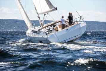
Some boats are still in the water or spend the winter completely in the water. The sails should be removed so that the storm has less surface area to attack. A furling jib in particular increases the wind load enormously. Special attention should also be paid to the mooring lines. Are they sufficiently dimensioned and free of damage?
If you have to expect lower water levels in the Baltic Sea, you should extend the mooring lines. It is also advisable to tie your mooring lines to the jetty and not on board, so that they can be lowered from shore without anyone having to climb down into the boat.
For boat owners whose yachts are already in winter storage, the storm is a particular challenge, especially if boats with a standing mast spend the winter outdoors. Special precautions must then be taken: "Vibrations in the rig should be avoided as far as possible," explains Sören Matthiessen from Gotthardt in Hamburg, rig specialist at the Seldén importer for Germany. "For example, you can lead the topgallant around the front of the empty furling jib and then attach it to the foot of the mast. Then the forestay can no longer strike so hard. Because movement always means wear and tear."
The Seldén Riggfibel has another tip for you: When the mast is upright in winter storage, the shrouds can also be easily loosened without being loose. However, the stays must remain tight. You can also pull in pilot lines instead of halyards to prevent them from snagging or wearing out due to excessive movement. Incidentally, it is not advisable to secure the rig with a halyard to a fixed point on the ground. The hull and mast must be able to move together so as not to increase the loads on the rig caused by the wind pressure.
Particular attention should be paid to the trestle on which the boat stands. It should be large enough and the boat should rest well on it.

