Meteorology episode 3: Recognising weather hazards and reacting correctly
YACHT-Redaktion
· 09.10.2022

In this series:
- Part 1: The basics.Wind, air pressure, temperature, humidity and more. What changes these parameters cause in combination
- Part 2: Of highs and lows. What influence the pressure formations have on wind development, how they develop and which constellations can be dangerous for sailors under certain circumstances
- Part 3: Weather risks. Whether fog or thunderstorms, hail or hurricanes: How sailors can recognise early on that trouble is imminent. Plus: How local effects influence the weather on site
- Part 4: Route planning. Using weather information, special services and apps to optimally prepare your own trip - how to do this and what you should pay attention to as much as possible
Part 3: Weather risks
by Sebastian Wache
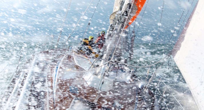
We already learnt last time that the weather can sometimes play havoc with us sailors: caution is required, especially when a cold front passes through. The excessive moisture in front of the front combined with the large temperature difference in front of and behind it, together with a rapid displacement speed, ensure the extremely rapid rise of cumulus clouds. But that's not all. This forward movement can also trigger a rotation, so that a so-called gust roll can form. This often brings with it stormy or even hurricane-force winds of over 100 kilometres per hour. This is then joined by thunderstorms and precipitation, not only in liquid but also in solid form.
The principle of evaporative cooling comes into play here. Everyone knows this from swimming outdoors: as soon as you get out of the water, a light breeze makes you shiver. The wind ensures that the water droplets on the body evaporate. This removes heat from the body, creating what is known as evaporative cooling. This also happens in the cloud when dry air masses, wind and water droplets meet. This in turn means that the air inside the clouds can cool down by itself as soon as precipitation occurs. In fact, this phenomenon is best observed in winter: If there are heavy showers during the cold season, this can initially take the form of rain. If the self-cooling process described above then sets in, the rain first turns into sleet and later into pure snow.
The dangerous downburst
But even in summer you can feel this cooling effect during showers. First and foremost on your own body. Of course, you can objectively read the drop in temperature on a thermometer. In the car, for example: If you drive from sunshine and 26 degrees Celsius into a shower, the values on the display quickly drop by a few degrees. The dangerous thing about this is the associated "downburst". The term refers to a very sudden strong wind directly from the raining cloud, which comes as unexpectedly and strongly as if a plug had been pulled in the cloud.
At this point, we remember the first part of this weather series: cold air is heavier than warm air. As the air in the mighty tower cloud can cool itself down, it also makes itself heavier. As a result, air rushes out of the cloud. And this does not necessarily have to be in connection with a cold front, which could have been recognised early on a ground pressure map. Smaller trough lines can be completely sufficient if the temperature difference is large enough and the moisture in the atmosphere is available as a necessary energy source. If you are not prepared in advance with the appropriate weather charts, when such clouds appear you have to reef the sails, tie everything to the deck, pick up the lifebelt and then go straight through!
But this is not without its problems. In summer, and especially in warmer regions, the processes within such a cloud are so powerful that the water particles are carried up into the ice area by the updrafts. There they freeze and grow into grains. If you are lucky, you will only get a shower of sleet. Things get more unpleasant when hail pours down from above. Then it's time to keep your head down! Hailstones the size of golf balls or even tennis balls are not uncommon in the Mediterranean region. On the North Sea and Baltic Sea, sailors usually get off more lightly, as the thermal energy input is lower here. However, you should not underestimate a heavy shower of sleet. They can really hurt.
20-centimetre-thick hailstones
Hail, on the other hand, is the hardest thing that can fall on your head from the clouds. The largest "ball" found and measured to date, from July 2010, had a diameter of 20 centimetres, a circumference of 47.3 centimetres and weighed 880 grams. It was found in South Dakota/USA. In Germany, the record is 14 centimetres in diameter. The corresponding hailstone fell from the sky in Reutlingen in 2013. Who knows, perhaps a helmet will soon be standard equipment for sailors in view of climate change.
THE DIFFERENCE BETWEEN SLEET AND Hail Both types of precipitation are often lumped together, but: sleet is white and soft, with a rough surface. Hail, on the other hand, is hard, clear and smoother. Sleet forms when water droplets in the cloud clump together to form miniature snowballs up to five millimetres in size. This usually happens until spring, when cold high-altitude air can flow in. Hail, on the other hand, forms as a result of strong updrafts and downdrafts within powerful thunderclouds. The raindrops freeze in the ice area, thaw again on their way down and freeze again on their way up. The hailstones continue to grow until they are too heavy for the updrafts - and fall out of the cloud. They are typical of the warm months when the clouds are at their highest.

Dangerous tornadoes
However, it is not only dangerous when sleet or hail forms, but also when the air masses start to rotate. They can then form a funnel. This column, also known as a funnel, occurs when water begins to condense at the lower edge of the clouds and this process becomes visible. If this rotating column of air reaches the ground, it is known as a tornado.
It doesn't matter whether you can see the entire column or not. The air or water close to the ground often swirls even though you can still see through it at the bottom edge of the column. It is therefore already in contact with the ground and can cause considerable damage. Not all the water has evaporated and is visible. This is deceptive, because you could still be lulled into a sense of security. However, videos on the internet show impressively how tornadoes swirl through buoy fields without you even being able to recognise them. As if by magic, boats are flipped 90 degrees on their sides and all loose items are swept off board.
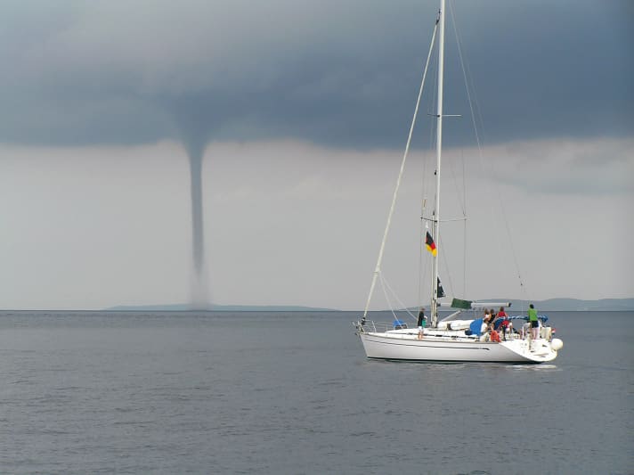
But when should you expect a tornado? Well, basically they can always occur when, for example, a large-scale thunderstorm cell - known as a supercell - forms and rages. However, most tornadoes occur over land and less frequently over water. There they tend to develop in weaker wind conditions, when the wind blows from slightly different directions with increasing height. The air can then begin to rotate. Showers and thunderstorm cells should usually still be in the early stages. Convergence lines close to the ground, where air masses flow together, often individual lines on a weather map, characterise such zones.
This is usually favoured by warm water as a base, over which cooler high-altitude air sometimes settles to trigger showers and thunderstorms. This in turn means that late summer and autumn are the times with the highest probability of a tornado forming. However, they also form in the cold season, as the water is also warmer than the often still very cold air from the far north. In short, tornadoes are basically possible wherever sufficient moisture is brought upwards, clouds form and air masses are blown from different sides by the wind and caused to rotate.
More and more tornadoes?
Whether climate change will lead to us seeing more tornadoes in the future is currently the subject of public debate. Studies show that the frequency has not increased so far. Quite the opposite. Even if it may seem as if they are forming more frequently, mobile phones and social networks in particular come into play here: tornado sightings reach the internet faster than before, so it feels as if there are more and more of them. However, the statistics remain relatively constant with around 70 observed tornadoes per year in Germany - even if the number of unreported cases is likely to be significantly higher. In contrast, scientists are less certain about their strength. One trend suggests that tornadoes could be more severe in future than in previous years.
Tornado or hurricane?
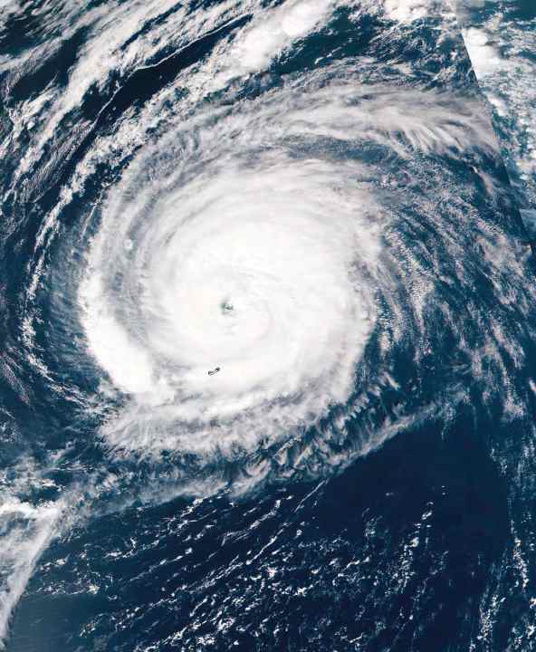
Tornadoes should not be confused with hurricanes or tropical cyclones. These are two completely different weather hazards. The size alone reflects this. Tornadoes usually have an impact radius of a few metres. Hurricanes, on the other hand, can be easily recognised even from space. They can be up to 1,500 kilometres in diameter. They usually form in tropical regions where the water reaches at least 26 degrees Celsius and thus sufficient water vapour is available. Slight wind shear, i.e. another change in direction of the air masses with height, as well as the Coriolis force caused by the Earth's rotation form the framework for the possible formation of these wide-ranging vortices.
As soon as such a disturbance has formed, first as a tropical depression, later as a storm and finally as a hurricane, the warm water ensures a kind of self-preservation of this powerful thermal depression. The core pressure often falls below 900 hectopascals. The core itself is often cloudless and calm. An eyewall only forms around 15 to 30 kilometres towards the edge. This is a huge wall of clouds, circular around the centre and up to 18 kilometres high!
Hurricane planes from the American weather services fly in and through the area to take measurements, which are then incorporated into the weather models. There are also impressive moving images of this on the internet. In particular, it is a breathtaking moment when the wall of clouds is broken, you fly into the core and suddenly there is complete calm in bright sunshine. It is precisely this wall around the core where the strongest wind blows. Speeds of over 200 kilometres per hour are the norm.
Hurricanes often form over the Atlantic Ocean near Cape Verde and then move westwards towards the Caribbean and the USA, becoming increasingly stronger. Most hurricanes turn off just off the coast of the continent. Their path is largely determined by the Azores High. If the high extends very far to the west, the hurricanes cannot turn off early. In this case, they hit Central and North America and there is a risk of considerable damage from wind and extreme water masses.
Especially in the often very warm Gulf of Mexico, the storms, some of which have already weakened there, can increase in energy and strength. Once they reach land or the cooler climes in the north, they weaken quite quickly. Later, they can be integrated into our low pressure track as extratropical storm lows. They then usually bring very warm air masses with them and sometimes encounter cold air from the far north in autumn. It is then possible for such a low to strengthen again. Furthermore, when these former tropical storms reach Europe, they herald a general change in the general weather situation here. They can be easily recognised on weather maps by their name, which they retain. They are simply preceded by an "ex-": "ex-Sandy" or "ex-Katrina". As a sailor, you then know that such a low can pass over us with squalls.
Weather extremes on the rise
A lot has changed over the past five years. Tropical storms and even hurricanes have formed at Madeira and even the Azores instead of Cape Verde. This was previously thought to be impossible so close to Europe.
Boris Herrmann and the Vendée Globe fleet had to contend with a tropical storm near Madeira shortly after the start in 2020, for example. And if we look a little further east in the Mediterranean region, we see a similar trend: weather extremes are on the rise. In autumn, cold air masses from the north meet increasingly warmer water.
In the worst-case scenario, a classic genoa low in the lee of the Alps can then develop into a so-called Medicane (Mediterranean hurricane) as a result of the energy supply from below from the warm water. In 2020, Medicane "Ianos" caused major damage, particularly in western Greece, with wind speeds of 150 kilometres per hour.
Caution with wind lakes
Water is also the keyword for the next dangers posed by the weather, or rather strong winds or storms: A considerable wind sea often builds up. In conjunction with the swell, i.e. the wave leading or following a low, the water masses gradually pile up. The wave systems from different directions then meet near a low core or when the wind direction changes during the passage of fronts. Interference occurs and the wave crests and troughs add up. Shorter and steeper waves become higher and higher in this way.
Such superimpositions can result in individual waves that are two to two and a half times the height of the other waves. During a hurricane off Ireland, for example, a significant wave height of 13 metres resulted in a single wave that was over 26 metres high. It was recorded by a measuring station on an oil drilling platform. So the stories of monster waves, freak waves, cavemen or the "three sisters" are by no means just sailor's yarn.
How fog is created
Another danger that can occur anywhere on the water, even on inland waterways, is fog. Sea fog in particular is often very dense, even if it is localised. But when should sailors expect fog? Put simply, fog is nothing more than clouds that form close to the ground. This happens when air masses cool down, can no longer hold the water vapour and it becomes visible. There are several types, such as cold and warm water fog as well as mixed or radiation fog.
If the water is still quite cold in spring but the air is already warm, it cools down over the water and fog can form. Conversely, this happens in the autumn months when the water is warm but the air is already quite cool at times. As soon as the cold flows over the water, the humid air near the surface is cooled and fog forms.
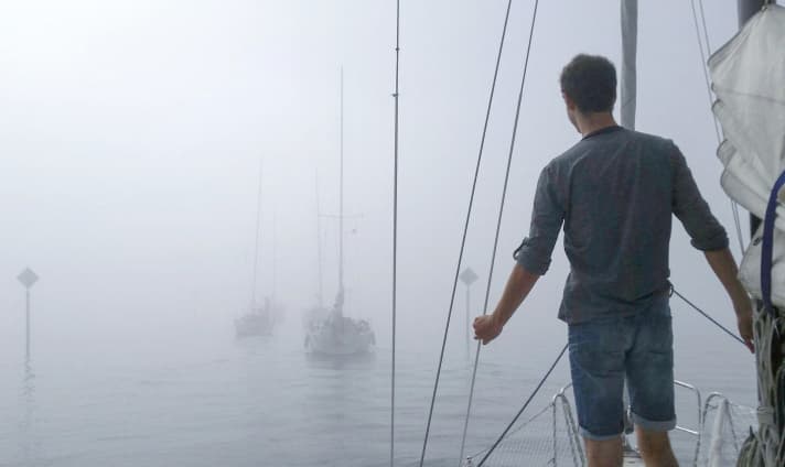
Mixed fog is subject to similar processes. Here, two different air masses are brought together by the weather situation or its change, which can lead to a supersaturation of moisture in the air as a result of their equalisation. The dew point is reached and fog forms.
On a smaller scale, this can be observed close to the ground in summer after a rain shower in strong sunlight. Finally, radiation fog often also appears after rain. If this is followed by a clear and longer night, it can cool down more due to the lack of cloud cover. However, the air is still moist due to the previous rain. As it cools down, the dew point is reached at some point and fog can form again.
The tricky thing here is that a clear and often calm night is an indication of an area of high pressure. If this remains in place for longer, it will remain calm and foggy in the days that follow. This is because there are often only three factors that can disperse fog: the sun, the wind or the mixture of air masses. However, the sun is too weak and low, especially in autumn. The wind has to blow at least five to six knots to mix the layers of air. Without wind, warmer and drier air is required to introduce undersaturation where the air is completely saturated and thus ensure clear visibility.
Radiation fog in particular occurs quite frequently in our latitudes in the autumn months. As it cools down more over land at night, fog from land can also drift out to sea. This means that after a sunny start to the sailing day, there is a risk of suddenly ending up in a dense bank of fog. This can sometimes be a very localised affair.
Using thermals correctly
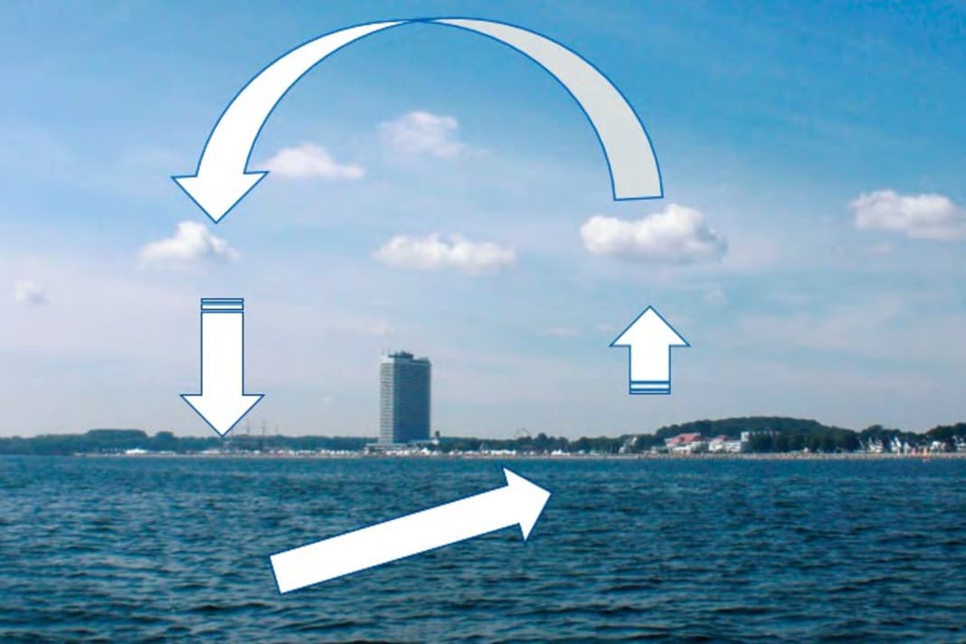


Thermals, and therefore the sea breeze, do not occur equally everywhere. This requires a temperature difference of at least four degrees Celsius between water and land. Ideally, the land should be warmer than the water. If there is even a light offshore wind of no more than five knots in the morning, this encourages the thermals to pick up as long as the sun heats up. As this system is very fragile, minor disruptive factors can lead to a collapse of the wind field. This can be the emerging wind field of a pressure system or too many clouds that don't let enough sun through. You are already in the doldrums.
It is also the clouds that can cast shadows over Travemünde, but no longer off Grömitz - and so it is still possible to sail well below the coast, while the engine has to be switched on off the Trave. As the air and water temperatures equalise towards late summer and autumn, a good onshore sea breeze becomes increasingly rare. In spring and early summer, on the other hand, thermals can build up much better in the afternoon on windless days. If you are unsure whether it is a sea breeze or not blowing into your sails, you only need to take a look at the coast. If you can see small cumulus clouds there, and only there, this is a visible sign of a sea breeze circulation. If a sea wind and a later gradient wind from the same direction overlap, it can even become stormy, with correspondingly high waves.
So we can see that different weather hazards can occur depending on the time of year and region. The advantage nowadays is that we as sailors can prepare ourselves well for this with the available data. The foundation for understanding the associated processes in the atmosphere has now been laid. In the fourth and final part of this series, we can therefore delve into the world of weather data. In episode 4, you can read about what you need, which weather apps are useful and what types of weather routing are available.
The author

Sebastian Wache is a qualified meteorologist; he works as an expert in marine weather forecasting and professional weather routing as well as a cruising and regatta consultant at Wetterwelt GmbH in Kiel. He regularly passes on his knowledge to sailors in seminars and also presents the daily forecast for Schleswig-Holstein on NDR television together with Dr Meeno Schrader. Wache is a keen sailor himself and enjoys sailing on the North Sea and Baltic Sea.

