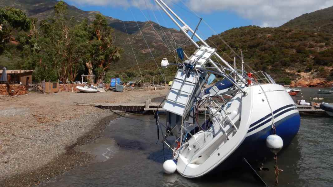
Last week, Corsica was hit by a severe Thunderstorm front hits which, in conjunction with a depression, moved north-eastwards across the island and then on to the northern Adriatic as far as Austria. Ten people died, dozens of yachts were stranded or sank in gusts of over 200 kilometres per hour. Even in Austria, high-voltage pylons were knocked down. We spoke to meteorologist and YACHT weather expert Dr Michael Sachweh about the storm and what lessons and conclusions can be drawn from it for Mediterranean sailors.
Do Mediterranean sailors now have to be increasingly prepared for such phenomena?
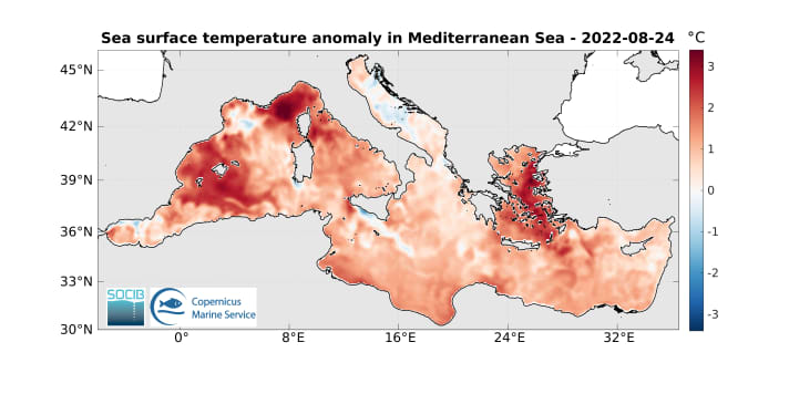
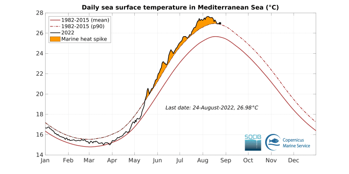
The unusually warm and sunny summer has led to a record-breaking warming of the Mediterranean Sea, with water surface temperatures of 27 to 30 degrees in many places. The warmer the water, the more water vapour evaporates into the atmosphere. In any unstable weather situation with the influence of low pressure or cold high-altitude lows ("cold air drops"), these large amounts of moisture condense in the form of huge thunderstorm cells. The overheated Mediterranean is therefore a ticking time bomb with a view to the autumn thunderstorm season that is about to begin! Sailors should therefore be prepared for particularly heavy thunderstorms in the off-season, with gale-force winds or even hurricane-force gusts, hail and deluges. Then 30 to 80 litres per square metre are possible in just one hour. This is not such a problem for sailors at sea, but marinas could virtually drown due to the temporarily raised sea level in the vicinity of rivers leading to the coast, especially if the wind blows onshore. Not to mention the flash flood-like devastation inland.
Do we have to get used to such extreme phenomena?
The storm over Corsica was quite unusual. A strong south-westerly jet stream in the upper atmosphere whipped the thundery hurricane front 300 to 400 kilometres to the north-east - from the west coast of Corsica via the Tuscan coast to the Gulf of Venice - and could not even be stopped by the Austrian mountains. An extreme weather situation that experts compare with the infamous "derechos" in the USA: A derecho is a thunderstorm front with gusts of well over 100 km/h in some cases, which races eastwards at high speed across a broad front over many hundreds of kilometres, causing enormous devastation. Such a phenomenon is very rare in Europe, but can also occur here in extreme situations such as powerful lows over a heated Mediterranean. The Mediterranean has cooled down a little after the storm on 18 August, but is still overheated. Sailors must therefore be prepared for a turbulent late summer and autumn with low pressure systems!
Is it actually possible to accurately predict such extreme thunderstorms?
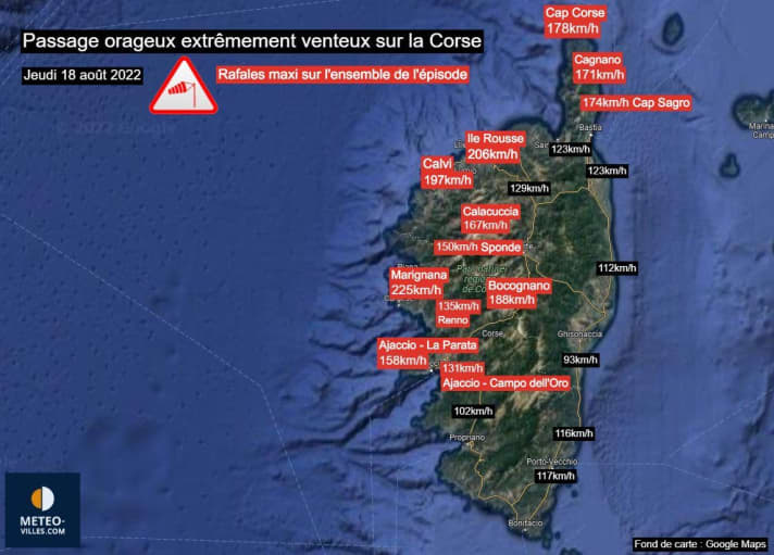
There were certainly warnings of severe thunderstorms and storms for Corsica, but the extent of the wind was extreme and surprising. Previous August records for wind peaks, which had stood for decades, were pulverised in a row by the Mediterranean derecho. Even on the east coast, which is protected by the mountains, more than 100 kilometres per hour was recorded. Wind force 12 starts at 118 kilometres per hour, on the west coast it was sometimes over 200 km/h! A tip: Check weather portals such as "Windy" for air currents three to five kilometres above sea level. If the wind there is gale force, you can expect heavy gales or even hurricane-force gusts near showers and thunderstorms, even on the water.
What can the skipper do to protect himself from being surprised by such events? Many crews off Corsica were caught cold at anchor or on buoys, and the boats drifted, got stuck, ran aground and sank.
Of course, look for a harbour sheltered from the wind direction the day before the forecast weather situation or, if not available, at least a very well sheltered bay. If a strong thunderstorm with squalls is forecast, or if it appears (current rain radar images in tools such as "Wetteronline") that such a storm has already developed and is on a collision course with us, the skipper should constantly keep an eye on the current radar image as well as the sky in the western quadrant! Wind readings from weather stations upwind can also help to estimate the expected wind.
Are there more long-term characteristics that indicate storms like the one in Corsica?
In good weather apps such as "Windy", you can see the air currents for the next few days. Using a slider, you can also see those in the higher atmosphere, up to the jet stream. The wind at altitudes of around 3000 to 5500 kilometres (pressure levels 700 to 500 hPa) is regarded as the leading current for the probable displacement of showers, thunderstorms and severe weather. If there is relatively low pressure up there and it is storming from the south-west, alarm bells should ring. A shore excursion instead of a cruise would then be the right decision.
In recent years, there has also been an increase Medicanes really whirlwind-like rotating lows that caused quite a bit of devastation in Greece in 2020, for example. Will they also be more frequent this year?
The potential for this is undoubtedly there due to the high water temperatures. It is therefore important to be particularly vigilant in terms of the weather in the Mediterranean this autumn. Medicanes usually only occur from the end of September/beginning of October and their peak season lasts into November. They require a closed high-altitude low, often triggered by an influx of cold Atlantic air into the Mediterranean. The enormous temperature contrast between the lowest atmosphere above the overheated waters and the cold high-altitude air is then able to produce an independent hurricane vortex very similar to a hurricane: a Mediterranean hurricane (Medicane). A stroke of luck: Medicanes are clearly recognisable as low-pressure vortices in the ground weather maps we are used to, and are therefore clearly visible in the forecast weather maps. Medicane "Ianos" 2020 was announced a few days in advance.

Andreas Fritsch
Editor Travel

