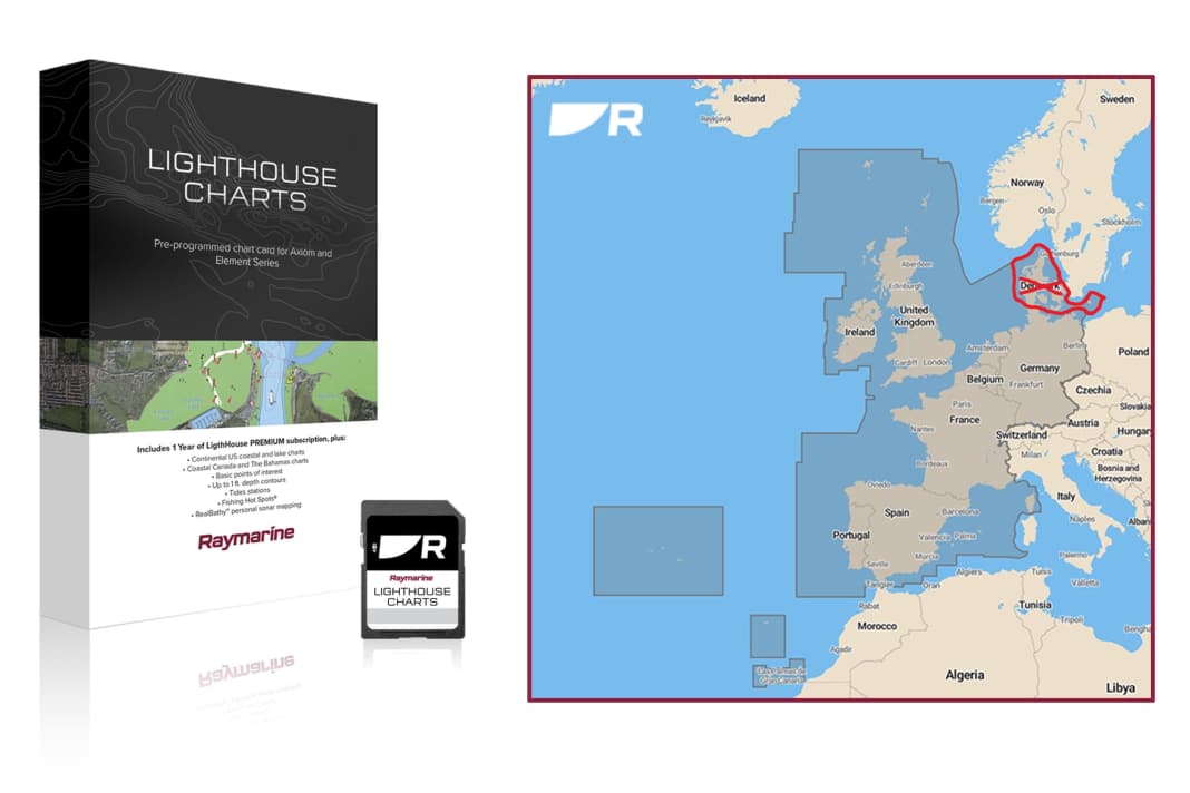


Whether on paper or digitally, updating nautical charts is part of on-board practice, but is not always without side effects with electronic charts. The latest case in point are the Lighthouse charts from Raymarine, more specifically the Western Europe chart set. Anyone who bought it last year was able to sail from the western Mediterranean via the Spanish, Portuguese and French Atlantic coasts to England and Scotland and via the Netherlands to Danish waters and around Bornholm.
After the update Denmark is missing
If you now carry out the paid update to bring the maps up to date for the season, the Danish waters disappear from the memory card. The insidious thing about this is that there is currently no warning, either during the update process or afterwards, that the same areas are no longer available. It is not possible to return to last year's version of the Western Europe chart set. Raymarine has assured that the update process will be provided with a corresponding notice in the near future.
The prices for the Danish licence are the problem
Raymarine cites the increased licence fees from the Danish Hydrographic Institute as the reason for the reduced coverage. In order to keep the price of the chart module constant, the Danish charts have been removed. In order to be able to sail in Danish waters with the Lighthouse charts, the chart set for Northern Europe or the individual chart set for Denmark must now also be purchased. These cost between 145 euros and 230 euros, depending on the provider.
The fact that the coverage of electronic map sets is changed during updates is unfortunately not a new problem. Years ago, Navionics removed Denmark from its Western Europe map set and turned it into a separate map set, which was also significantly more expensive than the entire Western Europe maps before.
Raymarine: We will find a solution
In response to our enquiry, Raymarine explained that the licence situation could not be changed, but that there would be individual solutions to the update problem. Anyone who owns the old Lighthouse Europe West chart set and wants to continue sailing in Denmark should contact support.
More on the topic

Hauke Schmidt
Test & Technology editor
Hauke Schmidt was born in Hanau, Hesse, in 1974, but moved to the coast at the age of an Opti and grew up sailing dinghies and tall ships. School and semester breaks were used for extensive Baltic Sea cruises. During and after his oceanography studies in Kiel, he took part in various international research trips to tropical and polar regions. The focus was on ocean currents and their influence on climate change. Eventually he was drawn back to his home coast and to YACHT. He completed a traineeship there and has been working as an editor in the Test & Technology department since 2009. His core tasks include equipment and boat testing, as well as practical topics relating to electronics, seamanship and refits. As a passionate DIY enthusiast, he loves to spend his summers on the water with his family and winters working on his boat
