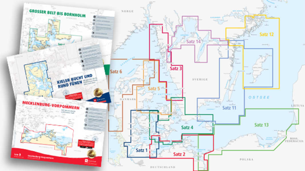
Up-to-date paper nautical charts are part of the basic equipment of every yacht. It is important to navigate with the latest nautical information, not only for legal reasons, but above all for safety on board.
Legal requirements for nautical charts
According to the Ship Safety Ordinance, up-to-date paper nautical charts must be carried on all ships flying the German flag, regardless of whether there is an electronic nautical chart system. This also applies to privately used pleasure craft. The waterway police monitor compliance with this regulation and can impose fines for violations, as has often happened in the past. Charts that are up to date with the current "Nachrichten für Seefahrer" are considered current. Non-official editions, such as those published by Delius Klasing Verlag, are sufficient for pleasure craft.
New purchase of nautical charts
The simplest method of updating is to buy new sets of charts. The Delius Klasing Verlag sports boat charts have just been published. can be ordered here.
Since 2024, Delius Klasing Verlag has been cooperating with Stentec for its digital versions of the leisure boat charts. The printed charts still come with licence codes that allow the charts to be used for 365 days after the licence code has been redeemed. In addition, by redeeming the licence code, you also receive a 365-day right to use the Stentec WinGPS app software for iOS or Android with all the important functions for navigation on pleasure craft.
Stentec offers apps for Android and iOS as well as various Windows programmes. All information about the digital Delius Klasing sports boat charts and the navigation software offered by Stentec you can find here.
Updating recreational craft charts
Correcting existing maps yourself is cheaper and more sustainable than buying new ones. Map publishers offer annual correction sets as well as corrections at different intervals during the year. These contain all relevant changes in the form of stick-on cover sheets and written correction instructions.
For the correction you need:
- Current correction documents (PDF or paper version)
- Sharp scissors
- Waterproof pen
- Waterproof glue stick
- Possibly a scalpel to remove old entries
The workflow is as follows:
- Carefully study the correction documents and allocate changes to the map sheets
- Cut out cover sheets exactly
- Carefully remove old entries
- Stick on cover sheets precisely, ensuring correct positioning
- Enter textual changes with a waterproof pen
- Note the update status on the edge of the map
Depending on the scope of the changes, it takes around 1 to 3 hours per set of cards. The cost of a correction set is around 20-40 euros, which is significantly cheaper than buying a complete new set of cards. You can find instructions with pictures here.
Advantages of independent updating
In addition to the cost savings, manual correction offers further advantages:
- More intensive examination of the map material
- Better understanding of changes in the district
- Flexible updating, even on the move
- Sustainable use of existing maps
In addition, the correction documents can also be carried as a PDF on mobile devices and accessed on the move if required.
Limits of paper map updating
Manual correction reaches its limits when map sections or scales change fundamentally. In such cases, the purchase of new individual map sheets is unavoidable. Even in the case of very extensive changes, the time and effort required for self-correction can be disproportionately high.
Electronic nautical charts on plotters cannot usually be updated manually. It is usually necessary to purchase updated chart chips. Some providers such as Navionics at least offer free online updates for limited periods.

Lars Bolle
Chief Editor Digital
Lars Bolle is Editor-in-Chief Digital and one of the co-founders of YACHT's online presence. He worked for many years as an editor in the Sports and Seamanship section and has covered many sailing events. His personal sailing vita ranges from competitive dinghy sailing (German champion 1992 in the Finn Dinghy) to historic and modern dinghy cruisers and charter trips.
