One of the most severe hurricanes in decades is expected to hit northern Germany tonight. Since Tuesday, meteorologists have been warning of a series of storms and gales that will sweep across Germany until the beginning of next week.
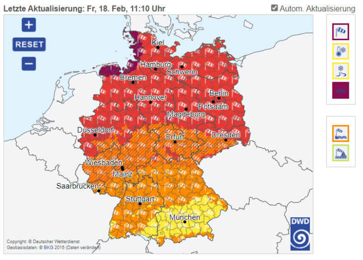
The warnings are now becoming urgent: the German Weather Service (DWD) is warning of particularly severe thunderstorms. The wind is expected to pick up again this afternoon and reach a peak in the evening and during the night. Extreme gale-force gusts of 150 km/h are being warned for the North Sea area.
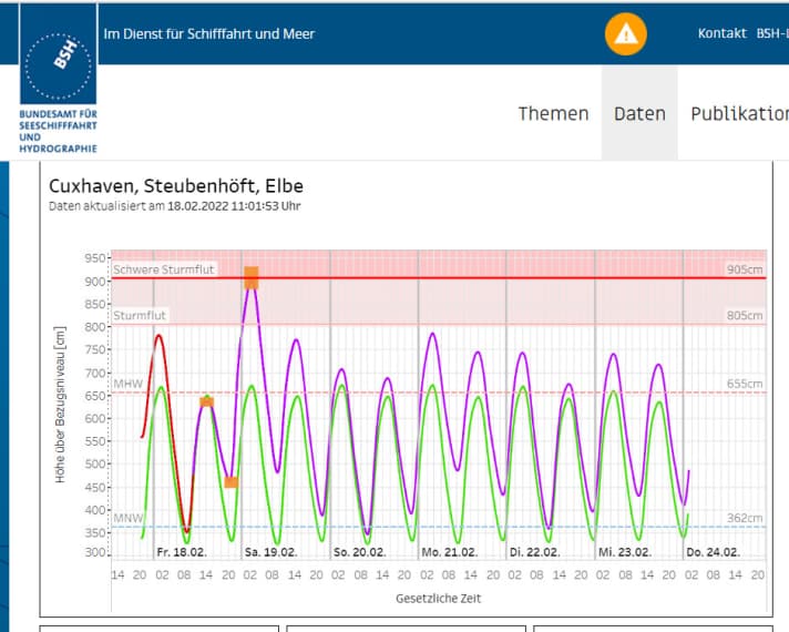
The BSH is forecasting a particularly severe storm surge for tomorrow morning, which will reach Cuxhaven 2.00 to 2.5 metres above mean high water, which corresponds to 4.12 to 4.62 metres above sea level. In Hamburg, the forecast is even 3.00 metres above mean high water, i.e. 3.12 metres above sea level.
For the Baltic Sea, on the other hand, there are warnings of extremely low water: "Water levels of up to 1.20 metres below the average water level are expected early on Saturday." Kiel and the Bay of Lübeck are particularly affected.
Low pressure system "Zeynep" is still west of the British Isles. "But it is moving extremely quickly and will be in the Baltic region tomorrow," predicts Sebastian Wache from the Kiel-based company Wetterwelt. He also warns that this depression harbours the potential for a so-called "Shapiro-Kayser cyclone", which is also referred to in the media as a "bomb cyclone". This is because "Zeynep" is being accelerated by a small area of very dry air over the Atlantic. "This can bring extremely violent gusts," continues Wache.
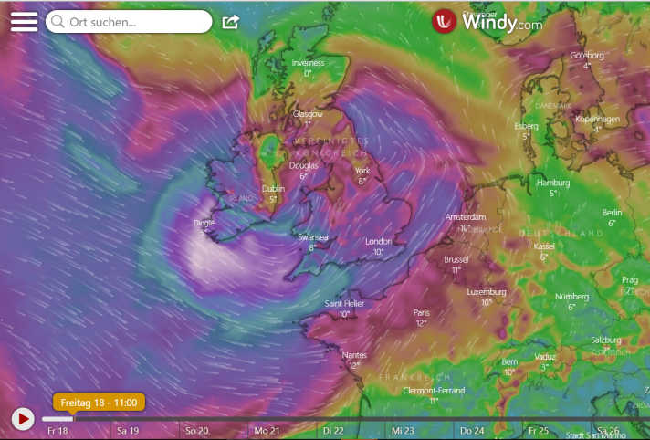
On Saturday, 10 to 11 Bft are still expected, which will also affect the south of Germany.
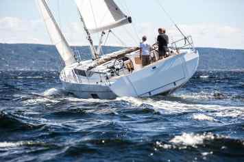
If you have your boat in outdoor storage or in the water, you still have some time to secure it! The continuous load that is expected to last for days can push lines, springs and mooring lines beyond their limits.
Winter tarpaulins can not only tear or blow away, as often happens in storms; they also increase the pressure that a hurricane exerts on a ship outside. They can also tear and bend railing supports. In view of the expected weather conditions, owners should consider whether it is better to remove the tarpaulin temporarily.
