
The maps are completely updated every two years - half of the entire material every twelve months. The content of Almanak II, a reference work with all bridges, locks and harbours in the Netherlands, is also updated annually. Each update is automatically incorporated into the apps. This means that anyone who takes out a twelve-month subscription will receive at least one update during the subscription period.

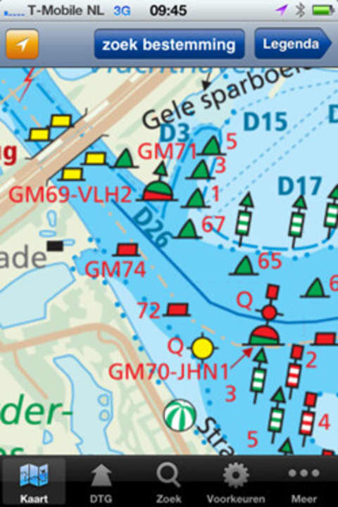
Working with the digital map is typical for Apple: move, zoom in, zoom out, click. Everything as usual. The telephone numbers displayed for the harbour master or bridge keeper can be dialled directly from the iPhone by tapping on them. The homepage can also be accessed from here. Reserving a berth in the harbour of your destination is therefore very easy. No more flicking through the thick Almanac to find a telephone number.
The fees are also user-friendly: The first seven days are free. This will particularly please charter guests who are only staying for a week. The second week then costs 3.99 euros, a month costs 8.99 euros and a year costs 34.99 euros. To the app: itunes.apple.com.
You can find out more about sailing in the Netherlands and navigation with iPhone and iPad in Yacht 9/2011. Further apps are presented in YACHT 10/2011.
