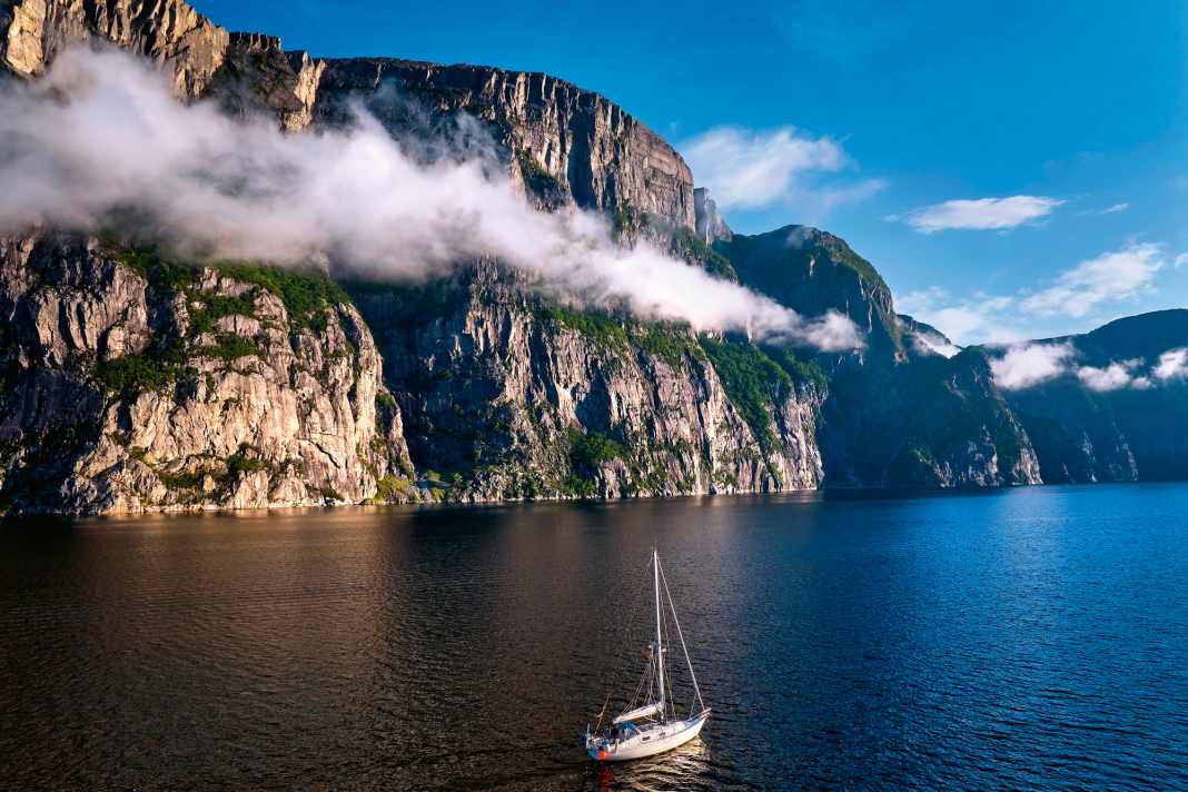


- The Lysefjord was formed when huge glaciers carved their way into the land
- The Preikestolen, 604 metres of almost vertical rock, is an Eldorado for hikers
- The car-free hamlet of Flørli has the charm of a Swiss mountain village
- The next highlight is not long in coming
- Stavanger reconciles with a pleasant mix of tradition and modernity
- Tips for the trip
- Highlights in the district
It is as if we are sailing into the middle of a fantasy film set: High above our heads, grey-white, rounded humps of rock tower up. Overhanging stone cliffs protrude metres from huge stone walls that rise vertically from the depths of the fjord all around us. Boulders of imposing size are scattered along the shore. In between, a few overgrown pine trees stand their ground, looking like trolls from a distance with their short branches. In keeping with this, the water glistens a mysterious green colour, interrupted by small white crests. Suddenly, a hole forms in the dense cloud cover, through which the sun's rays illuminate the pristine landscape as if focussed through a lens. We watch the spectacle spellbound.
The day is drawing to a close, dawn is already breaking behind the mountains. In the fading light, the rocks seem to get closer and closer, the passage narrower and narrower. Spooky. We wouldn't be surprised if a six-headed dragon flew over us from astern and a troop of dwarves waved their pickaxes at us from a rocky cave.
Also interesting:
But fantastic flying creatures and hobbit figures or not, reality catches up with us: We are travelling after sunset in an unfamiliar, narrow Norwegian fjord. We have just passed the village and small harbour of Forsand and sailed under the huge wing of the Lysefjord bridge. Now we urgently need a place to spend the night, whether at anchor or on a jetty.
There is neither one nor the other in abundance in the fjord. On the contrary. However, we discovered a spot with moderate water depth in the sailing guide. After a few more miles, the anchor drops to a sandy bottom in Vikavägen. Shortly afterwards, as if by magic, darkness falls over us and our ship.
The Lysefjord was formed when huge glaciers carved their way into the land
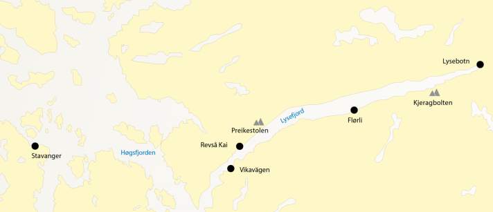
After a quiet night and a morning swim, the immense beauty of the surroundings is revealed this time in the light of the rising sun. The Lysefjord is a natural wonder, formed during the Ice Age when huge glaciers carved their way into the land. When the world warmed up again, the sea added the finishing touches and moulded the rocky gorge into its current shape. The terrain is rugged and inhospitable and almost inaccessible. The steep banks in many places mean that there are no roads along the fjord. The population is correspondingly sparse. There are only two villages, one at the beginning and one at the end of the 42-kilometre-long inlet: Forsand and Lysebotn. About halfway along the northern shore is Songesand, a small area of mainly farmhouses. Several other small scattered settlements on the shores can only be reached by boat.
The Lysefjord is not only long and narrow, in some areas it is almost as deep as the mountains are high. In the west, where it flows into the sea near Forsand, it also begins relatively shallow with a depth of just 13 metres. The further it cuts inland, the more it drops under water: to over 400 metres!
On the way back from Bergen towards Gothenburg, the detour inland was not originally planned. Rather, the fact that there was a lack of anchorage, that there were only a few tiny harbours and that the wind was blowing from only two directions over the rocky waters, like in a gigantic wind tunnel, seemed more of a deterrent. But then I saw the pictures and read the stories in the travel guide, harbour handbook and internet: "The Lysefjord is unique and promises breathtaking nature experiences, a fjord in its most beautiful form!" The photos showed waterfalls, hiking trails on breathtaking high plateaus, climbing walls for mountaineers, kayaks on mirror-smooth water. Was it just good advertising, or did it really look like that? My curiosity was piqued.
And not just mine. The day before, three freshwater sailors I had met in Stavanger signed on. They are students who are using their semester break for a hiking adventure in Norway. They really wanted to hike up to the legendary Preikestolen, this imposing rocky pulpit high above the fjord. Unfortunately, they had missed the ferry to the Lysefjord. Without further ado, they asked if they could sail with me to the foot of the famous rock platform. So there are four of us on board and we now leave the beautiful anchorage. Helleren lies on the south side of the fjord behind a headland. There is only a small, exclusive restaurant belonging to the ferry company Rodne Fjordcruise in this secluded spot. A location for special occasions such as weddings or anniversary celebrations, accessible only by water.
The Preikestolen, 604 metres of almost vertical rock, is an Eldorado for hikers
The gentle morning breeze takes us further and further into the fjord. None of us are in a hurry, it's hard to get enough of the spectacular scenery. Even if our necks get stiff from constantly staring upwards. Then we reach our destination: there is a small jetty near the Preikestolen, the Revså Kaii. It's hard to make out in the low-contrast morning light. Eventually, however, we discover the narrow concrete bridge. It is as if glued to the rock, framed by huge boulders. Towards the water, large, disused car tyres serve as fenders. Only the ferries of the fjord traffic are allowed to moor here, but a stop is permitted for dropping off and picking up hikers. If you want to stay overnight, you can moor at the side of the pier, but only with a small boat. Of course, it would also be possible to set up a shore line to one of the rocks, but passing boats create a lot of swell. It's not for the faint-hearted.
The young hiking crew jump ashore, heavy rucksacks and climbing ropes flying behind them. "Ahoy and see you next time!" The sturdy shoes crunch in the gravel, then they are already out of sight, disappearing on the narrow, steep path that leads uphill in many hairpin bends. A few miles later, I see the famous Preikestolen towering next to me: 604 metres of almost vertical rock, with the pulpit clearly visible at the top. It is the destination of thousands of tourists every year. The view from a distance is enough for me. I can't even imagine the crowds up there: Hundreds of people in an area not even the size of two tennis courts. And the abyss on three sides!
I continued the journey for a few more miles and discovered a waterfall that plunged from the fjell into the fjord from a dizzying height. The spray of fresh water blows right up to the foredeck, and this unexpected natural shower is used spontaneously and ice-cold.
The car-free hamlet of Flørli has the charm of a Swiss mountain village
Sailing in the fjord works much better than expected, the wind is usually moderate and from the west. However, there are extreme jet effects from time to time and the gentle breeze suddenly turns into a strong wind. You have to be prepared for this. The short distances are an advantage, as the fjord only cuts 20 nautical miles deep into the land. This also makes it ideal for family crews. Especially as there is plenty of variety.
For example, when Flørli suddenly appears on the starboard side behind a rocky hut. The pier of a former hydroelectric power station serves as a jetty, behind which rusty pipes wind like giant snakes up the mountain to a reservoir. This is where the longest wooden staircase in the world leads. It's quite something. Not least because all 4,444 steps have to be climbed individually to conquer the 750 metres in altitude. The reward for the effort is a fantastic view of the vast fjell and fjord landscape. Deep down, your own boat is just an inconspicuous tiny dot on the water.
The car-free hamlet of Flørli has the charm of a Swiss mountain village. Small cabins can be rented by holidaymakers, and many hikers come down from the fell every day and populate the paths. There is something to eat and beds to sleep on in the old power station. An old ferry has moored at the jetty. It is now casting off and signalling that it is about to return to Stavanger.
Those who can stay in Flørli are in luck. Many people leave the village, which is now quiet and cosy, on the ferry. As dusk falls and it gets noticeably cooler, logs are lit in the stove under a wooden tub. They bring the fjord water to a pleasant temperature. Shortly afterwards, sociable sailors from all over the world sit together with some hikers in the hot tub on the pier. This helps to relieve calf cramps and sore muscles and puts everyone in a good mood.
The next highlight is not long in coming
I continue the trip the next day. The next highlight is not long in coming. The mountain Kjerag, described by locals as the crown jewel of the Lysefjord, lies almost at its end, a few miles from Lysebotn. As you pass the thousand metre high rock face, you can even see the Kjeragbolten with binoculars. This is the large rock that has been photographed thousands of times, stuck in a crevasse and hovering above the abyss for over 12,000 years. Of course, everyone wants to take a selfie there. However, this is anything but easy and requires a good deal of courage. Unlike Preikestolen, which almost everyone can now climb, Kjerag has a steep path. It divides the tourists into those who want to reach the summit and those who want to turn back.
Some of those who make it to the top don't bother with the way back. They plunge headfirst into the depths. They are base jumpers who use the steep rock to experience almost a kilometre of free fall. A parachute only stops them on the last few metres. They land on a small peninsula. What an adrenaline rush that must be - unimaginable!
The supplies are running low and a new crew member needs to be picked up. With a heavy heart, I make my way back, out of the magnificent mountain and fjord world and into civilisation: Stavanger. The city is, of course, a stark contrast to the previous nature experience.
Stavanger reconciles with a pleasant mix of tradition and modernity
Stavanger's old town centre pleases the eye with its well-preserved white wooden houses and charming narrow streets. They give you an idea of what life was like here in past centuries. Back then, the city was one of the most important trading centres in the north. Today, modern architecture characterises the other part of Stavanger. This includes the concert hall and the art museum. There is a lot going on culturally, with festivals taking place all year round in addition to art galleries, museums and theatres. The city can afford it, the natural fossil fuel deposits deep under the seabed off the coast have brought prosperity to the country and also to Stavanger.
In the city harbour of Vågen, the boat is moored at Skagenkaien in front of pubs, cafés and restaurants. The atmosphere is lively and loud, with an idiosyncratic composition of pop music from loudspeakers, the squawking of seagulls and ships' horns in the air. For me, it's time to stock up on provisions and diesel, wait for the right weather window and then set course south. Time to say goodbye. The excursion to the Lysefjord was more than just a short detour. It was an unforgettable journey into a fabulous world of rock and stone.
Tips for the trip
Admittedly, the area is not exactly around the corner. But those who take the long journey will be rewarded
Arrival
The Lysefjord is easily accessible as part of a longer summer or chain cruise with changing crews. From Kristiansand it is 130, from Thyborøn 180 and from Skagen 220 kilometres on your own keel.
Charter
There are no large sailing yacht hire companies in this region of Norway, as we know them from the German Baltic coast. But: The Yachtico network organises charter yachts from 40 feet from Stavanger/Vestre Amoy. Info: yachtico.com
Navigation
The fairways are all clearly buoyed, otherwise the water in the fjord is always sufficiently deep. Little swell, hardly any current. The tidal range in Stavanger and Lysebotn is 0.5 metres.
Harbours & moorings
There are a small number of harbours and jetties, mostly combined with the commercial vessels of the fjord traffic. Due to the short season and ice conditions in winter, the facilities in the fjord are usually small and simple. The harbour fees for 26 to 40-foot yachts are the equivalent of around 27 euros. Mooring on the rocks is sometimes possible, anchoring only in exceptional cases. Be aware of the swell from passing boats. Make sure you have long lines, rock hooks, thick fenders, a fender board and a stern anchor with 50 metres of line ready. Danger of falling rocks on the steep walls, keep your distance!
Wind & Weather
Often cloudy with temperatures of 15 to 19 degrees Celsius. It is slightly warmer in the fjords. The water temperature is 14 to 17 degrees. On average 190 days of rain a year, so it can get wet. Best time to visit: early July to late August. The wind blows moderate to fresh in summer with an average of three Beaufort. Jet effects in places!
Literature & Charts
- Territory guide "Norway" by Judy Lomax in cooperation with the Royal Cruising Club, Imray-Verlag, 80 euros
- Harbour guide "Havneguiden 3 - Lindesnes to Bergen", Skagerrak-Verlag, 75 euros; NV Charts "Norway NO5: Sørvestlandet South, Flekkefjord to Stavanger", 75 euros
- Official maps "Norway N 16: Southwest coast Tananger-Stavanger- Skudenes", and N 132 "Høgsfjorden to Lysefjorden", both approx. 28 euros each, Kartverket Norge. Purchase via hansenautic.de
Highlights in the district
Lysebotn and Kjeragbolten: Adventures at lofty heights
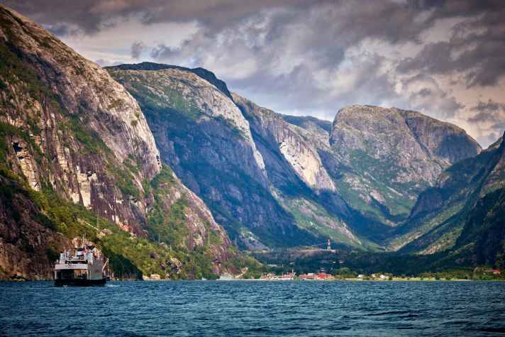
At the end of the Lysefjord lies the village with its small harbour and ferry dock. Yachts can moor alongside the jetty in front of and behind the pier. The water depth is 1.6 to 2.0 metres. However, it is not possible to anchor. Today, the town lives from camping and hiking tourism. The world-famous Kjerag rock is used by base jumpers as a ramp for the 1,110 metre jump into the depths (information: sbkbase.com). Many hikes here are also possible as day trips. There are bus and ferry connections to Sandnes, Jorpeland and Stavanger - good for crew transfers or excursions.
Stavanger: capital of oil
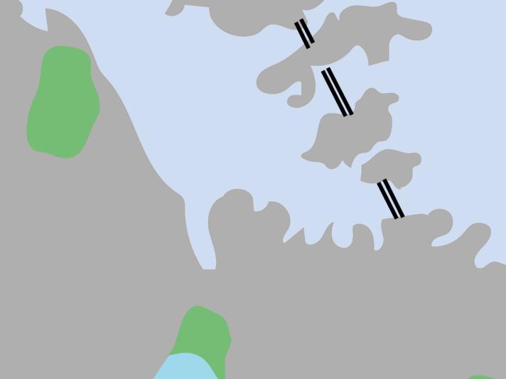
The cathedral metropolis, founded in the 12th century, has lovingly preserved its old town and warehouses. Today, Stavanger lives from tourism and oil. The Oil Museum provides an insight into the world of fossil fuels. The Kongeparken amusement park provides a dose of adrenaline with the steepest ski jump, the largest carousel and the longest bobsleigh run in Norway. The moorings in Vågen town harbour on Skagenkaien are central, but there is swell from passing ships. Water and electricity at the quay, sanitary facilities within walking distance. Børevigå Gjestehavn, right next to the oil museum, is quieter.
Flørli: Stairway to heaven
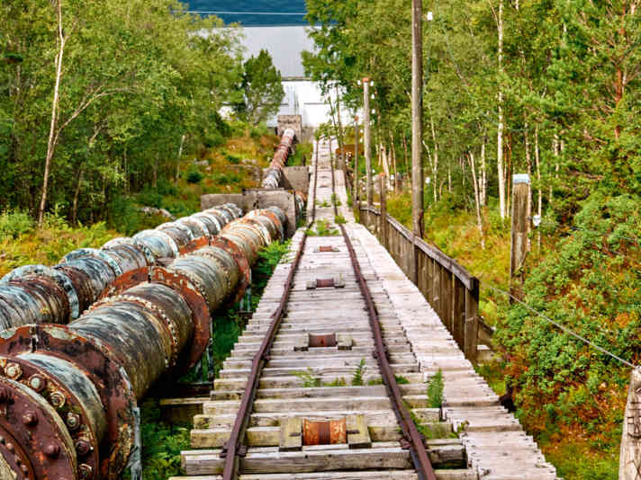
There is an 80 metre long jetty at the former power station. Moor there free of charge at the stern buoys. Keep your distance from the jetty due to swell from the ferry and excursion boats. No electricity, no water. But there is a steam bath. The old power station centre houses a hostel with WC, bar and restaurant as well as a small range of groceries. Along the old downpipe of the hydroelectric power station, 4,444 steps lead to the Troppekosnuten plateau. With a length of 1,600 metres and an ascent of 740 metres, this is the longest wooden staircase in the world. Also on site: hire kayaks and hikes. Info: florli.no
Høgsfjorden: a protected archipelago paradise
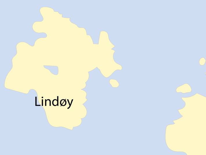
The area lies between Stavanger and the Lysefjord. Local water sports enthusiasts will find a diverse island landscape right on their doorstep. There are countless opportunities to go ashore in small natural harbours. The area is well protected from the often strong westerly winds. A gem in this region is the island of Lindøy, less than three nautical miles from Stavanger's city marina. Moor at the small jetty or on the rocks. Drinking water and sanitary facilities are available. Many day visitors at weekends, however, as a passenger ferry docks here.
Revså Kai: at the foot of the Preikestolen
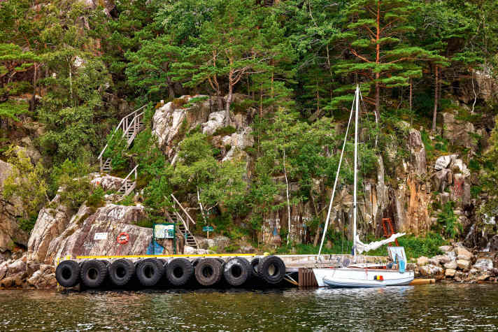
The spectacular rocky pulpit above the fjord is very crowded with tourists. It is best to hike from the small jetty to the Preikestol hut (3 km; overnight stay possible) before sunrise and then along Lake Revsvatnet to the plateau (3 km/350 metres in altitude). Sturdy footwear is obligatory. The Revsa quay serves as a ferry landing stage; pleasure craft can moor briefly to embark and disembark. Smaller yachts can moor at the rear quay or on the rock faces. Attention, swell, a crew member should always be on board. Overnight stays only possible to a limited extent. Numerous boat names are immortalised on the rocks all around.
Vikavägen: lonely anchorage in the fjord
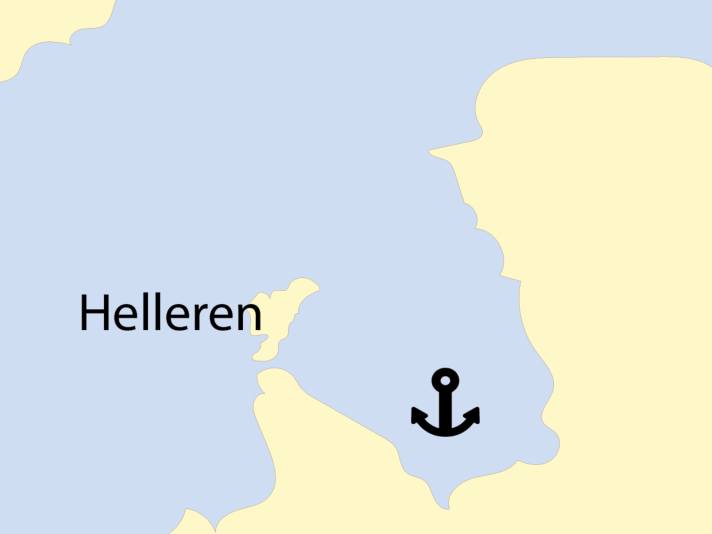
The village can only be reached by water. The "Lysefjord-Helleren" restaurant is located on land and is ideal for weddings and celebrations in a romantic setting. The sheltered bay is suitable for anchoring. Water depths of 12 to 18 metres on sand and mud. Alternatively, anchor in front of the stern with the bow on the rock hooks on the inside of the headland. Motorboats can be anchored further out with their own rock pegs, water depth there around 0.5 metres. If no excursion boat is moored, you can lie alongside on the restaurant jetty. The area is ideal for bouldering, hiking and paddling.

