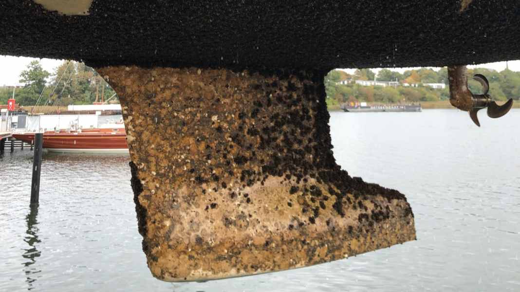
Protection against fouling: Biocide-free antifouling - yes or no? The fouling atlas provides information
Fabian Boerger
· 15.02.2025

For many pleasure boats, a fresh coat of antifouling is as much a part of the start of the season as a six-monthly tyre change on a car. New layers of protection are applied annually or every two years in the hope of keeping pox and mussels away from the hull. The Federal Environment Agency estimates that biocide-containing coatings are used in 95 per cent of cases.
They release substances that are toxic to pests into the water via diffusion (hard antifouling) or by continuously dissolving the binder (polishing antifouling). This is to prevent the underwater hull from becoming a carpet of mussels. The problem is that these substances can harm not only the pests, but also the environment in general. However, toxic coatings are not always necessary everywhere.
Vegetation atlas shows regional differences
This depends, among other things, on the so-called fouling pressure, which varies in strength in different bodies of water. The composition of the organisms responsible for fouling varies regionally and seasonally; moreover, conditions can change from year to year. The fouling atlas is intended to provide information on local conditions. An interactive map uses a traffic light system to show where which organisms are present and to what extent, and what can be done to combat them.
Regions where heavy fouling is to be expected and barnacles, mussels or calcareous tubeworms can settle on the hull are marked in red. Zebra and quagga mussels can occur in yellow regions; the fouling usually has a soft consistency and does not adhere very firmly. The regions with low fouling pressure are labelled green. Mussels do not occur here and the growth rarely goes beyond a biofilm.
How strong is the vegetation in your region? Find out for yourself:
Less fouling, less aggressive coatings
The fouling protection should also be selected according to the conditions, according to the website of the Federal Environment Agency. This means that less aggressive, more environmentally friendly paints are sufficient where there is no risk of heavy fouling. "Our focus is on demonstrating more environmentally friendly alternatives. There are now numerous biocide-free alternatives. However, they don't necessarily make sense in all waters," says Sascha Setzer from the Federal Environment Agency. After all, the conditions on the coast are different to those in inland lakes; the suitable products or measures that can be chosen are correspondingly different.
In addition, the technical possibilities in the area of fouling protection have improved considerably. Nowadays, antifouling products containing biocides are no longer the only solution to counteract heavy fouling. Some biocide-free methods and systems also perform effectively in regions with high fouling pressure.
You can read about the alternatives and how effective they are here:
Enlightenment since the 90s
The vegetation atlas is the result of an initiative by the Limnomar research institute in Hamburg. The institute collected the data, carried out research and published the atlas for the first time at the end of the 1990s. The Federal Environment Agency later took over the atlas, updated the data with the help of a special expert report and has made it available on its website since around 2019.
In the near future, the main focus will be on ensuring that the data is up to date, says Setzer. The map is currently based on completed surveys rather than regular monitoring. "The vegetation varies greatly from season to season. As this can also change from year to year, it is important to keep the data up to date," says Setzer. That's why the plan is to rely more on boat users in future to contribute to data collection on site.
More on the subject of "antifouling":
Vegetation atlas update with "Civic Science"
The project could run as follows: Boat owners or harbour operators leave fouling plates in the water for a set period of time. The fouling is then photographed or the plate is sent in for analysis to determine the organisms that have colonised it. The data obtained is collected in a database and visualised on a map. However, this idea is still in its infancy, says Setzer. The pilot project is to be launched this year. Only at the end of this year will it be possible to predict how and whether the project will be opened up to the general public.


