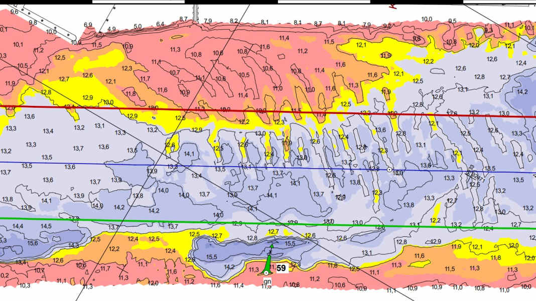
The Federal Waterways and Shipping Administration (WSV) is making a new service available on the Internet: On the Waterway information portal ELWIS a depth atlas of the federal waterways is now being developed.
Measurements for safety
The data was collected during the detailed survey of the waterways, i.e. either the river bed or the seabed in the area of the respective shipping route and fairway. It is important in order to ensure navigability and to be able to rectify possible restrictions such as reduced depths on the part of the responsible waterway and shipping authorities (WSA).
First and foremost, the visualisation includes depth data of the fairway at the time of the measurement. The data at the measuring points is displayed in figures, as is usual on nautical charts, and additionally along the depth contours in a colour scheme, albeit much more colourful and contrasting.
The depth atlas is divided into volumes to limit the file size and to divide it into federal waterways. The files are stored in PDF format. The cover sheets are an integral part of the individual volumes and must be observed for the correct interpretation of the maps.
What the in-depth atlas has covered so far
The depth atlas will be built up successively, using the most recent depth data. The depth maps will be updated on a volume-by-volume basis, each time with a new issue date, whereby no sequence is specified.
Information is currently available for the following waterways: Ems, Hunte, Küstenkanal, Lesum, North Sea - Jade, North Sea - East Frisian coastal waters, North Sea - Weser, Rhine, Weser and Wümme
