


- 1. nature and culture - Allinge and Sandvig
- 2. south harbour Gudhjem - holidays in the shelter of the rocks
- 3rd Svaneke - shopping spree and hygge style
- 4. so close to the fine sand - Snogebæk's mini harbour
- 5. best connections - the harbours of Rønne
- 6. fresh fish from the cutter - Hasle
- 7. small pearl with potential - Vang
- 8. look into the history - Hammerhavn
- Tips for the trip
As soon as you arrive from the sea, Bornholm impressively reveals what makes it so special. Despite its compact size, the island combines all the beautiful landscapes that are so typical of Scandinavia: smooth granite cliffs and steep rocky coasts covered in pine trees, as well as a green, gently rolling landscape covered in fields and forests. And there is even a dune landscape with the finest white sandy beaches. This island also plays a special role when it comes to temperatures: the "heat reservoir" of the Baltic Sea gives Bornholm a microclimate with mild winters, which even allows figs and lemons to thrive here in season. Mooring your boat in the small historic fishing harbours is like immersing yourself in a world and time all of your own. A trip ashore offers many possibilities: swimming, jumping off cliffs, cycling, hiking, visiting museums and craft workshops, eating ice cream or eating fish specialities directly in the traditional smokehouses. Or simply lazing on a warm cliff in Gudhjem or in the fine sand of Dueodde. The advantages are obvious, even if the journey from Germany is relatively long. It is around 80 nautical miles from Rügen and around 200 from Kiel.
However, a crew change can enable two crews to experience a sea voyage with long strokes plus a cosy island holiday. Once you have arrived, the island offers quick relaxation, as the distances to the nearest harbours are very short and a pure coastal voyage is without navigational challenges. After all, yachts can also cruise along the coast of Zealand and southern Sweden, from Kåseberga in Skåne to Hammershus on Bornholm is less than 30 nautical miles. Whatever the cruise plan, everyone is rewarded when Scandinavia's jewel appears on the horizon.
1. nature and culture - Allinge and Sandvig
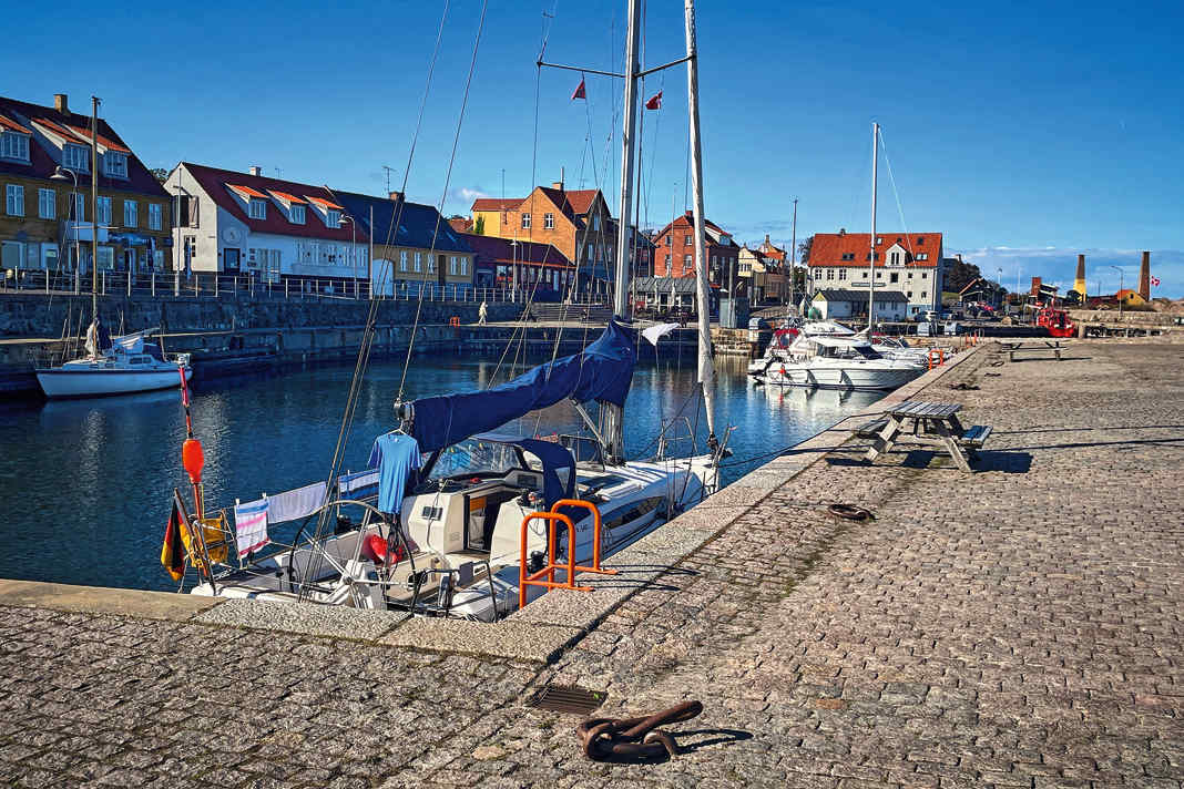


Wild cliffs and gentle beaches: these places are the cradle of Bornholm tourism. With their magnificent and well-marked hiking and cycling trails along the rocky coastline, they make every holidaymaker's heart beat faster. There is also a marvellous bathing bay right at the gates of Sandvig.
Shore leave
The rocky area around the northern tip of Hammerodde and Hammershus Castle or the view of Opal Lake, a former quarry from the second half of the 19th century, are particularly scenic. In addition to the harbour, the smokehouse in Allinge with its striking chimneys and the yellowwashed church are eye-catchers. To the north-west is the Madsebakke cliff, where prehistoric rock carvings have been found. Tip: Swim in Sandvig Bay first and then head to Allinge for freshly smoked fish from the historic smokehouses.
Nautical
The villages have grown together to form one municipality, but have retained their own harbours.
Sandvig Havn
Small fishing and yacht harbour for a maximum of 15 smaller boats with a draught of up to 1.4 metres. Only enter the harbour during daylight and in good, clear weather. The leading light leads into the harbour at 175 degrees.
Allinge
The fishing harbour and marina, blasted into the rock, has 60 berths. Approach taking wind, current and visibility into account. Do not enter in strong onshore winds. A strong current can cross the harbour, in which case the flagpole displays a black ball or three red lanterns on top of each other. The harbour's leading light points to 264 degrees; it is extinguished when entry is prohibited. The harbour gate between the outer and inner harbour is closed in strong south-easterly winds. Guests can moor in the inner harbour or alongside on the quay of the outer harbour with a maximum draught of up to 4.40 metres.
2. south harbour Gudhjem - holidays in the shelter of the rocks
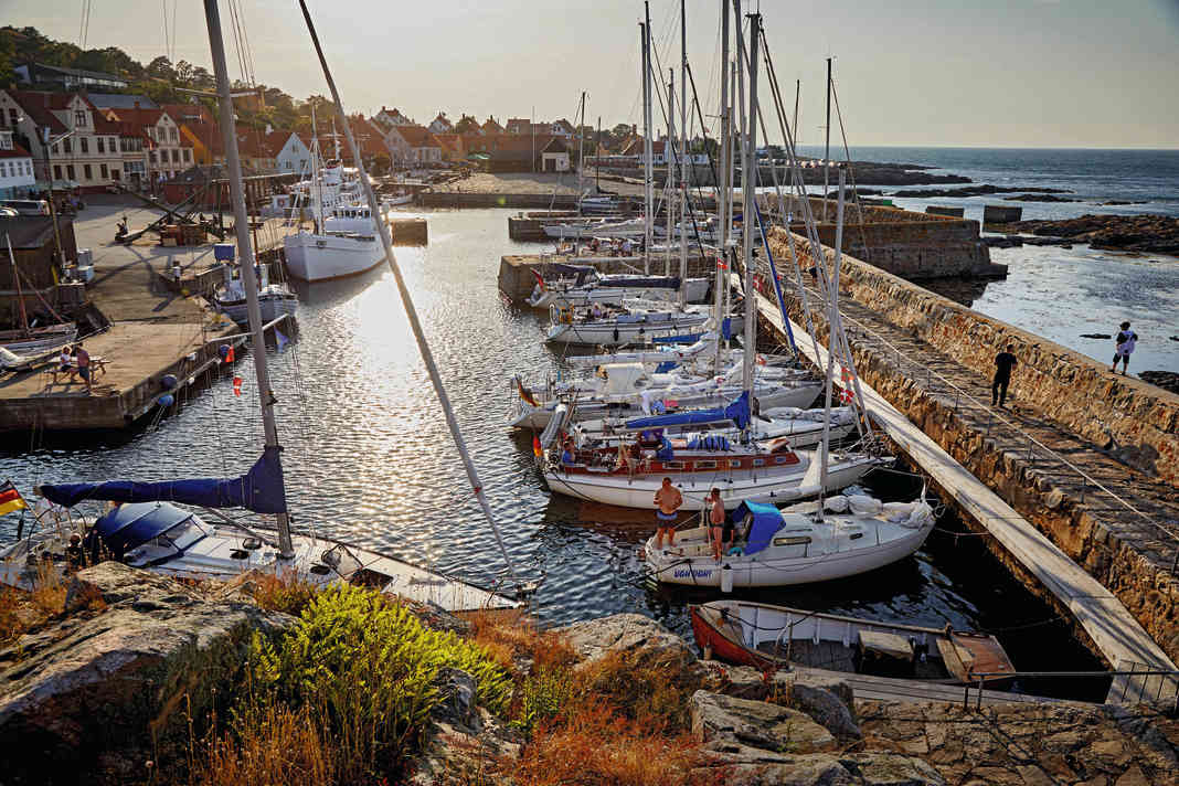


When smoked fish was an export hit, this fishing village had its heyday. Many ovens still bear witness to that time, and the smokehouses still sell their fresh produce today. At times, the town was home to a lively art scene centred around the famous Bornholm painter Oluf Høst.
Shore leave
The Oluf Høst Museum displays an extensive collection of the painter's work, while the Gudhjem Museum exhibits contemporary performing artists. A beautiful coastal hiking trail leads to the Helligdomsklipperne, impressive rock formations overlooking the sea. Characteristic of Bornholm is the church of Østerlars from the 11th century, located about five kilometres to the south.
If you don't want to take your own boat, take the ferry to the Pea Islands and visit the old Christiansø sea fortress on a day trip. And then it's time for dinner, with the Bornholm speciality Sol over Gudhjem ("Sun over Gudhjem") on the menu: rye bread with smoked herring, chives and a raw egg yolk on top.
Nautical
Yachts with a draught of up to 3.90 metres are welcome in the east basin of the southern harbour, while the landward quays are reserved for passenger ferries. The leading light points the way at 202 degrees. In strong sea winds, the capacity of the harbour basin is reduced and the gate between the inner and outer basins is closed when the wind force exceeds 6 Beaufort. The harbour has new sanitary facilities and WLAN. In the north harbour (Nørresand Havn) there is a small basin with space on the south and west jetties with a water depth of 3.6 metres.
3rd Svaneke - shopping spree and hygge style


The beautiful former fishing harbour and trading centre with its own beacon is considered a stylish shopping highlight on the east coast.
Shore leave
Boutiques, artists, arts and crafts, coffee shops and ice cream parlours pass the time and empty the ship's coffers. However, you can watch the more curious "chicken poo pooing" for free - a kind of lottery where you can guess on which marked field a Bornholm chicken will drop its droppings. Wednesdays from the beginning of July to mid-September.
Nautical
The harbour has 30 berths, but local yachts have priority in the inner harbour basin. The outer harbour, with a water depth of 4.4 metres, is very choppy in onshore winds. The gate to the inner harbour is closed in sea winds from around 6 Beaufort, which is then indicated by three black balls or three red lanterns on top of each other on the northern signal mast. The leading light line points into the harbour at 297 degrees. But beware: If you follow the leading light directly from the east, you will be led over the Mügeflad flat! It is therefore essential that you continue northwards!
4. so close to the fine sand - Snogebæk's mini harbour
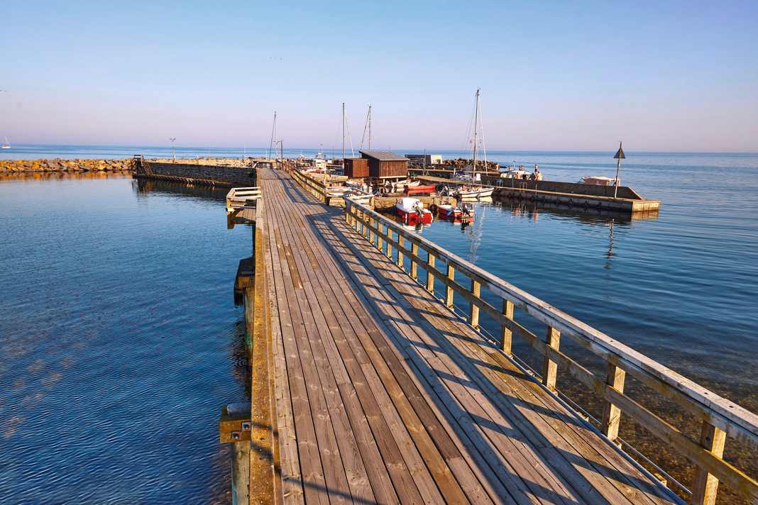


The large smokehouse bears witness to the importance of fishing even here at the south-eastern tip of Bornholm. It is not far by land from the small fishing harbour to the kilometres of fine sandy beaches and coastal dunes of Dueodde and Balka.
Shore leave
The former fishing village has blossomed into a lively tourist resort with a mini market, ice cream parlour and chocolate factory with its own local production, artisan workshops and a restaurant to which the locals also travel many kilometres. The fantastic beach and dune area of Dueodde are around five kilometres away and can be easily reached by bike.
Nautical
The small private fishing and dinghy harbour at the end of a pier can be approached easily in clear weather, the leading light shows 318 degrees and leads safely past Broens Rev. There is very little room in the 2 metre deep inner harbour; yachts can lie alongside at a water depth of around 3 metres on the outside of the jetty at the entrance and to the south at the bathing pier, except when the wind blows from the south-east. Siltation must be expected. The harbour master comes to collect the fees in the evening, but there is not (yet) a machine here. If you want to have the beach directly in front of your bow, you can also anchor off Dueodde at a depth of 4 metres during the day, weather permitting, and take the dinghy from there to go ashore.
5. best connections - the harbours of Rønne


The large commercial harbour of Rønne is the nautical centre of the island, where ferries arrive from the Swedish and German mainland, making crew changes easy. The airport with scheduled flights to Copenhagen is also not far away, and there are many shopping opportunities, shipyards and cultural and gastronomic potential.
Shore leave
Rønne is an old merchant town founded in 1327 and has a lot of history and culture to offer, such as the 19th century merchant's house Erichsens Gård, the ceramics museum with workshops from Hjorth's factory or the Nicolai Church, surrounded by historic half-timbered houses. In addition to many restaurants and cafés, the Torvehal celebrates culinary diversity: specialities from the Mediterranean and local Bornholm products such as beer, gin and jam delight guests' palates.
Nautical
Nørrekås is located just north of the commercial harbour and is a comfortable marina for leisure boats with a draught of up to 3 metres with a jetty and dolphins. In Nordhavn, large yachts can go alongside in 5 metres of water, while the small Søndre boat harbour (between Nordhavn and Sydhavn) can be used by small yachts with a draught of up to 1.70 metres. The harbour is a ferry harbour with screw water and swell.
6. fresh fish from the cutter - Hasle
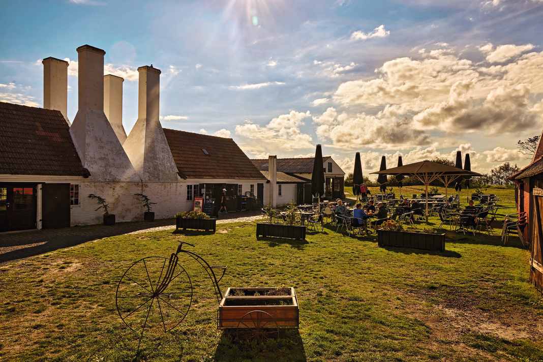


Hasle harbour may not have the lovely charm of the harbours in the east of the island, but the rustic and active fishing, trading and yacht harbour has a character all of its own. The harbour offers good shopping facilities, cafés and smokehouses with restaurants, and the fishermen's fresh catch can be bought directly from the cutter. The harbour is increasingly being developed for leisure sailors, and a holiday home project has been integrated into the harbour in the north.
Shore leave
The old smoking tradition is upheld at the Hasle Røgeri museum smokehouse, at the end of the new canal to the south stand the typical smokehouse chimneys and piles of aromatic wood for the smoker. Herring, salmon, mackerel and cod are smoked here in the traditional way and can be eaten directly on site. You can get hands-on with craftsmanship at Grønbechs Gård, where there is a café with fresh cakes and pastries next to the open ceramics workshop. Just east of Hasle is the three-metre-high Brogårdstenen runic stone from the Viking Age, and not far away to the north is the steep granite coast that stretches all the way to Hammerodde. Here lies Jon's Cape, a lonely cliff with a steep staircase of 108 steps leading up to it.
Nautical
The harbour is very well protected, spacious and safe to call at day and night in all weathers, the leading light shows 93-101 degrees. The harbour master can be reached on VHF 2.13 and 16. The marina in the north is suitable for boats up to 10 metres, others can moor in the first two basins of the commercial harbour.
7. small pearl with potential - Vang
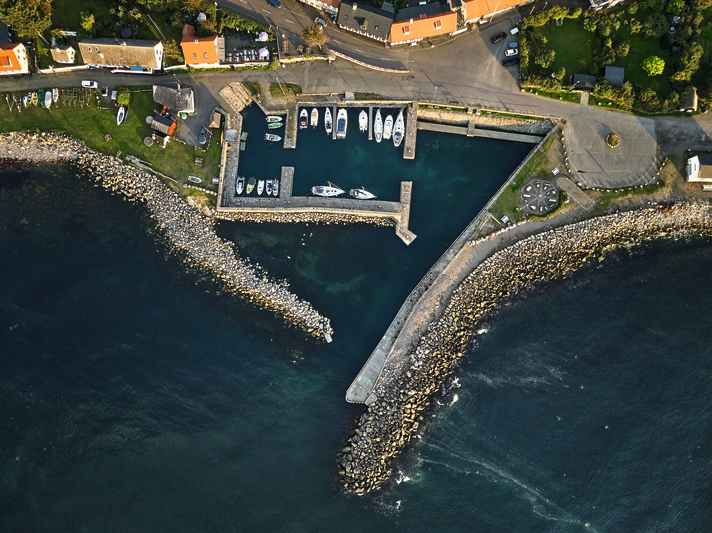
A quaint little harbour that offers good shelter between Rønne and Hammershus. The harbour basin with its massive outer pier nestles against the steep coast, colourful half-timbered houses line the street.
Shore leave
The walk along the coast to the north offers a nice change of pace, the path leads along the beach at the bottom and then goes up through heath and rocky landscape with fantastic views of the sea and the ruins of Hammershus Fortress (see picture opposite). The gourmet restaurant "Le Port" provides culinary delights and is known to gourmets far beyond the island. The view from the terrace is particularly sensational at sunset.
Nautical
Yachts are well protected from the high western breakwater in all winds except north-west to north. There is room for around 25 boats in the outer (swell in north-westerly winds) and middle harbour basins, mostly in packets in summer. The service facilities are adequate and simple, but not designed for large crowds. The harbour master comes by in the evening to collect money. The leading light is 155 degrees.
8. look into the history - Hammerhavn
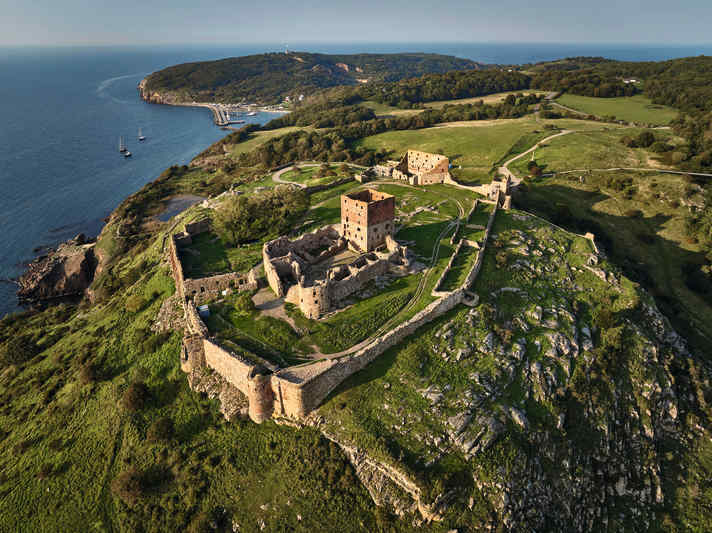
South of the Hammerknuden headland and below the castle ruins of Hammershus lies the Hammerhavn granite quay. Built for the shipment of granite, the former loading point is now a good marina in a unique location.
Shore leave
Hikes on Hammerknuden offer far-reaching views across the sea to Sweden. A visit to the castle ruins, one of the largest in Northern Europe, is an exciting experience. Unforgettable: end the day up here with a sundowner. There is a small sandy beach in the bay of Hammerhavn and kayaks can be hired. If the sea is calm, you can visit the Våde Ovn rock cave by dinghy or SUP.
Nautical
It is almost always possible to enter the harbour without any problems, only in stormy westerly winds is the harbour entrance impassable. In the high season it can get tight. You can moor alongside in the outer basin, even in a packet. Sanitary facilities and kiosk with snack bar in the wooden houses. Electricity along the outer pier.
Tips for the trip
Bornholm has a year-round population of 41,000, almost half of whom live in the capital Rønne. The area is almost 590 km², 40 km long and 30 km wide, and the coastline measures 158 km.
Weather and climate
The special location in the centre of the southern Baltic Sea provides the island with a temperate maritime climate and an ideal balance between summer and winter, with fewer temperature fluctuations between the seasons. This allows plants such as melons, wild grapes and figs to thrive. The average summer temperature is around 20 degrees, but can also exceed 30 degrees. Over the course of the year, it stays warmer for longer than in neighbouring regions.
There and gone
Sassnitz on Rügen is an ideal port of departure, from here it is another 50 nautical miles to Rønne. Depending on the harbour of departure and wind direction, Klintholm on Møn can also be a good starting point; Rønne is about 80 nautical miles to the east.
Navigation and territory
Vigilance is required in sea areas with increased traffic in the Kadet Channel: It is considered the most difficult and dangerous fairway in the Baltic Sea. When approaching Rønne, the Hadderev and Hvideodde Rev shoals can be dangerous in uncertain weather and strong winds. Misreading of the magnetic compass is possible. Bornholm is characterised by a typical wind phenomenon on large islands: The wind can blow fresher on the leeward coast than upwind.
Nocturnal
The harbours of Rønne, Hasle and Nexø can also be accessed at night, while other harbours are hardly or not at all lighted. A wind farm project is being planned south-west of Bornholm, and the construction site is likely to cause restrictions.
Harbour money
"Havnepenge" is usually paid at vending machines and amounts to between 200 and 300 Danish kroner (around 26 to 40 euros) for a 10 to 13 metre boat, with electricity sometimes being added. Volume discounts are possible in municipal harbours.
Get round
Marked hiking trails lead along the coast. There are great cycle paths and you can explore the island on your own or on a hire bike. Public buses also go almost everywhere.
Charter
Various providers in the Rügen region or national online providers organise yachts of different sizes, such as Mola Yachtcharter in Breege on Rügen or Yachtcharter Greifswald.
Charts and manuals
Sport boat charts set 1, 2 and 4 set: "German Baltic Sea Coast and Southern Danish Baltic Sea" (Edition 2024) // Cruising guide "Denmark 2: Funen - Zealand - Lolland - Falster - Møn - Bornholm" by Jan Werner (both Delius Klasing Verlag).

