Strict regulations in the 300 metre zone
Strict rules apply to motorised watercraft in Denmark within the 300-metre shore zone, for example to protect bathers. Although the exact regulations may vary depending on the regional police district responsible, restrictions generally apply, particularly with regard to the maximum permitted speed. This is usually five knots.
A major problem for recreational boaters, however, was that there was no standardised nationwide information available. Where exactly the line to the 300 metre zone ran was rarely clear to skippers underway, or at least sometimes more or less easy to judge depending on the course of the coast.
Maps from the police and from Garmin
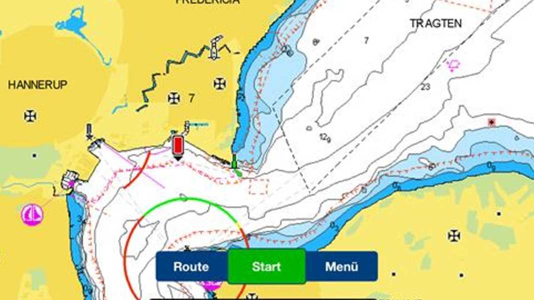
In order to clarify the situation, the Danish police have now published a digital map onlinewhich shows the 300 metre zone as mandatory for all regions, but can only be used to a limited extent on the water. However, Garmin also reacted immediately and added the information on his Navionics charts in. The seaward boundary of the 300 metre zone can now be seen there as a dashed red line.
The ordinances of the police regions
If you want to avoid fines, you should also be aware of the regulations that apply in the 300 metre zone depending on the region. Together with the police map, these links have also been bundled on one page to make it easier for users to access the information. Here is an overview of all water sports regulations:

Christian Tiedt
Editor Travel
Christian Tiedt was born in Hamburg in 1975, but grew up in the northern suburbs of the city - except for numerous visits to the harbor, North Sea and Baltic Sea, but without direct access to water sports for a long time. His first adventures then took place on dry land: With the classics from Chichester, Slocum and Co. After completing his vocational training, his studies finally gave him the opportunity (in terms of time) to get active on the water - and to obtain the relevant licenses. First with cruising and then, when he joined BOOTE in 2004, with motorboats of all kinds. In the meantime, Christian has been able to get to know almost all of Europe (and some more distant destinations) on his own keel and prefers to share his adventures and experiences as head of the travel department for YACHT and BOOTE in cruise reports.
