

When the "MSC Zoe", one of the world's largest container ships, rolled in stormy seas off the coast of the Netherlands in early 2019, a total of 342 containers crashed into the water. These drifting or grounded containers not only pose a significant risk to shipping, but also caused pollution in the Wadden Sea. Thousands of shoes, fridges and packaging waste from broken containers were washed ashore. The Dutch Safety Board then emphasised the need for active traffic control in order to minimise the dangers in extreme weather conditions.
Active traffic management - registration is also mandatory for sailors
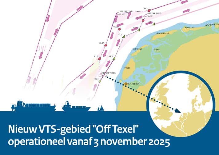
The new VTS area offers the possibility for navigators to actively assist ships around the clock in bad weather and, for example, recommend the northern route instead of the southern route, which runs closer to the sensitive Wadden Sea region. The southern route is 20 to 30 kilometres off the coast, but in stormy north-westerly winds it is particularly susceptible to cargo losses as the waves are at right angles to the route. Since 3 November, any vessel wishing to enter the VTS area off Texel must report via VHF channel 63. Even though the designated area is largely within the Traffic Separation Scheme (TSS), recreational skippers are also required to comply with the obligation to register.

What is a VTS area?
A VTS area is a geographically defined area on the water where ships receive traffic control from a control centre, similar to air traffic control. The aim is to increase the safety and efficiency of shipping by providing information and coordinating traffic flows in busy areas such as harbours, canals and access roads. For example, there are VTS areas off Cuxhaven or near the port of Rotterdam.
