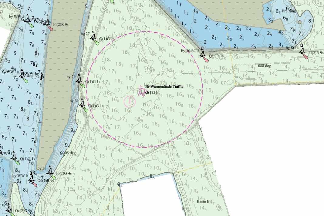
Navigation: Electronic nautical charts become even more accurate with "HD ENC"
Christian Tiedt
· 05.06.2024


Electronic navigation is playing an increasingly important role as shipping traffic on busy sea areas and waterways increases, especially in terms of safety. This is particularly true for commercial shipping, but such trends are also generally being introduced quickly in recreational shipping. The use of GPS and AIS are just two examples of this.
The main feature of the new HD-ENC charts is the much more detailed depth information in higher resolution and with depth contours at 1 metre intervals instead of the previous 5 metre intervals, which enables a higher degree of safety, particularly when navigating near the coast. The first chart now available is the Rostock harbour (see illustration), and other areas will follow continuously.
Electronic nautical chart: HD ENC as an intermediate step
The shipping industry has repeatedly asked the BSH whether the higher resolution of the depth image could be utilised before the launch of the S100 standards, which was developed by the International Hydrographic Organisation (IHO), could be incorporated into the electronic nautical chart, explains Thomas Dehling, Head of the Nautical Hydrography Department at the BSH. This was possible: "We have been working intensively on the preparation of S100 for years and can now fulfil this request," says Dehling.
Updates will also be faster in future: As soon as the survey reports new data, it will now flow directly into the new HD ENC. With the previous BSH products the electronic data is updated at the same time as the paper charts.
